
Source: Bureau of Meteorology
Issued at 11:34 am CST on Thursday 21 March 2024
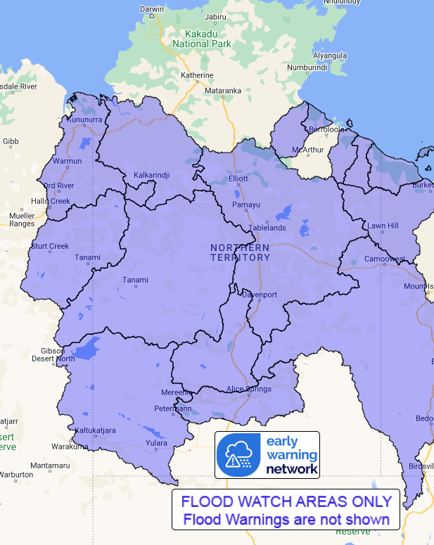
Flood Watch Number: 16
RENEWED AND INCREASING FLOOD RISK FOR THE CARPENTARIA COASTAL
RIVERS AND CENTRAL PARTS OF NORTHERN TERRITORY
Ex-Tropical Cyclone Megan is over the Gregory District and will
move westwards into the Kimberley in WA on Friday. Heavy to intense
rainfall will remain a threat with the system, primarily over its
southern flank.
Catchments in the Flood Watch area are relatively wet and
responsive to rainfall, and river levels remain elevated in parts
of the Flood Watch area.
Isolated rainfall totals up to 65 mm were recorded across the
Flood Watch area in the 24 hours to 9:00 am Wednesday following
several days of heavy falls.
Rain and storms with isolated heavy falls are forecast over the
next few days. Widespread daily totals of 50-100 mm are possible
during the next few days across the Flood Watch area. Isolated
heavy falls in excess of 150 mm are possible, with the heaviest
totals likely to occur to the south of the system.
The recent observed rainfall is causing flooding impacts, and with
further rainfall forecast, impacts will be become more widespread
and severe over the coming days. Flood impacts may include road
closures, including primary and secondary highways, and isolation
of communities and homesteads. Check road conditions before
travelling.
A Major flood warning for McArthur River and a Moderate Flood
Warning for the Daly River are current.
A Severe Weather Warning for heavy and locally intense rainfall
for parts of the Tanami and Barkly districts.
Catchments likely to be affected include:
Upper Victoria River
Victoria River below Kalkarindji
Limmen Bight River
Rosie River
Robinson River
Calvert River
Settlement Creek
Nicholson River
Tanami Desert
Barkly
Central Desert
Western Desert
MacDonnell Ranges
Georgina River and Eyre Creek
East Kimberley Rivers
Sturt Creek District
Flooding is no longer expected in the following catchments
Waterhouse, Roper and Towns Rivers.
See www.bom.gov.au/australia/warnings to view all of the Bureau's
current warning products.
More information on the Flood Watch Service and maps of Flood
Watch areas are available at
www.bom.gov.au/water/floods/floodWarningServices.shtml .
Flood Safety Advice:
The Northern Territory Emergency Service advises that people
should:
* Stay away from flooded drains, rivers, streams and
waterways.
* Prepare for flooding and move away while safe to do so.
* Don't drive into floodwaters.
For emergency help in floods, storms and cyclones call 132
500.
Emergency information is available at www.securent.nt.gov.au
.
The latest road conditions are available at
www.roadreport.nt.gov.au .
Rainfall and River
Conditions Map
21/Mar/2024 02:21 AM


