
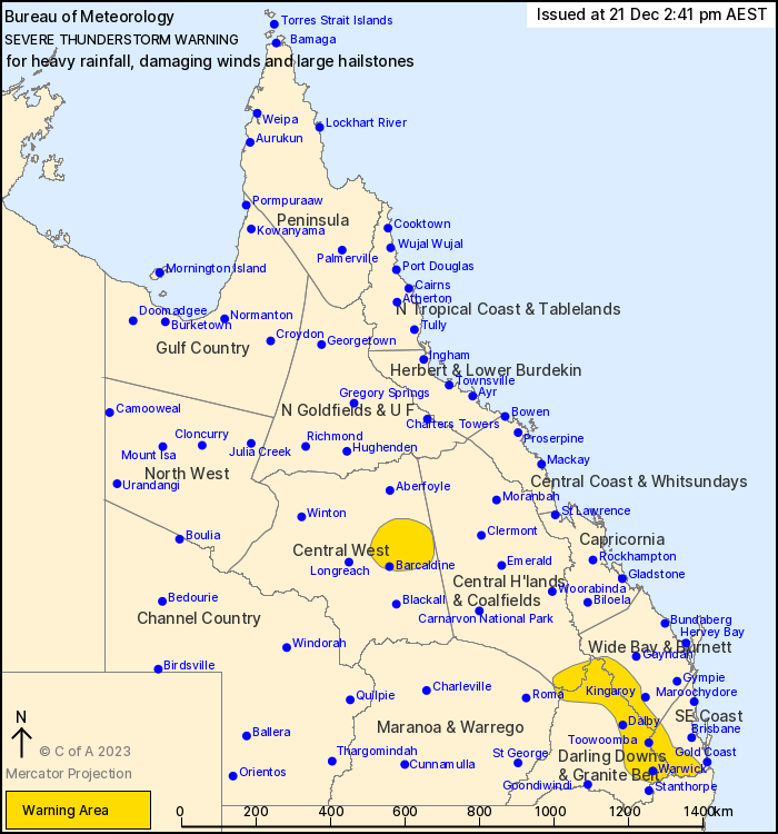
Source: Bureau of Meteorology
For people in parts of Central Highlands and Coalfields, Central
West, Wide Bay and Burnett, Darling Downs and Granite Belt,
Southeast Coast and Maranoa and Warrego Forecast Districts.
Issued at 2:41 pm Thursday, 21 December 2023.
Severe thunderstorms have developed over inland parts of the
southeast and the interior.
Weather Situation: Slow moving severe thunderstorms have developed
along a trough in a very humid airmass through inland parts of
southeast Queensland this afternoon and are expected to continue
throughout the afternoon and into the evening.
Severe thunderstorms are likely to produce heavy rainfall that may
lead to flash flooding over the next several hours in parts of the
Central Highlands and Coalfields, Wide Bay and Burnett, Darling
Downs and Granite Belt, Southeast Coast and Maranoa and Warrego
districts. Locations which may be affected include Warwick,
Toowoomba, Dalby, Beaudesert, Gatton and Laidley.
Severe thunderstorms are likely to produce damaging winds, large
hailstones and heavy rainfall that may lead to flash flooding over
the next several hours in parts of the Central West district.
Locations which may be affected include Barcaldine and
Aramac.
79.0 mm was recorded in 1 hour to 12:09 pm at Upper Bracker Creek
(West of Stanthorpe).
43.0 mm was recorded in 1 hour to 12:40 pm at Dalcouth
44.0 mm was recorded in 30 minutes to 2:38 pm at Millbrook
Emergency services advise people to:
* Park your car undercover away from trees.
* Close doors and windows.
* Keep asthma medications close by. Storms and wind can trigger
asthma attacks.
* Charge mobile phones and power banks in case the power goes
out.
* Put your pets somewhere safe and make sure they can be
identified in case they get lost.
* Do not drive now unless you have to because conditions are
dangerous.
* Tell friends, family and neighbours in the area.
* Go inside a strong building now. Stay inside until the storm has
passed.
21/Dec/2023 04:47 AM


