
Source: Bureau of Meteorology
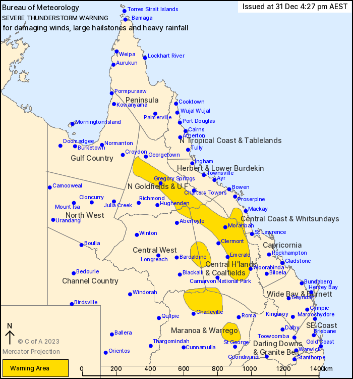
For people in parts of Northern Goldfields and Upper Flinders,
Central Coast and Whitsundays, Central Highlands and Coalfields,
Central West, Maranoa and Warrego and Capricornia Forecast
Districts.
Issued at 4:27 pm Sunday, 31 December 2023.
Severe thunderstorms continue about parts of interior
Queensland.
Weather Situation: Moisture and instability to the east of a
surface trough, and an associated upper trough tracking across
southeastern Queensland, are enhancing thunderstorm activity across
parts of eastern Queensland.
Severe thunderstorms are likely to produce damaging winds, large
hailstones and heavy rainfall that may lead to flash flooding in
the warning area over the next several hours. Locations which may
be affected include Blackwater, Moranbah, Rolleston, Pentland,
Capella, Dysart, Nebo, Eungella and Alpha.
Emergency services advise people to:
* Park your car undercover away from trees.
* Close doors and windows.
* Keep asthma medications close by. Storms and wind can trigger
asthma attacks.
* Charge mobile phones and power banks in case the power goes
out.
* Put your pets somewhere safe and make sure they can be
identified in case they get lost.
* Do not drive now unless you have to because conditions are
dangerous.
* Tell friends, family and neighbours in the area.
* Go inside a strong building now. Stay inside until the storm has
passed.
31/Dec/2023 06:40 AM


