
Source: Bureau of Meteorology
For people in parts of North Tropical Coast and Tablelands and
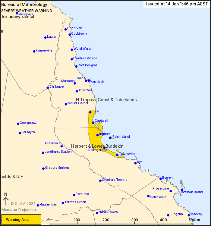
Herbert and Lower Burdekin Forecast Districts.
Issued at 1:46 pm Sunday, 14 January 2024.
Bands of heavy rainfall developing about the tropical coast on
Monday morning.
The monsoon trough lies across the base of Cape York Peninsula and
over the western Coral Sea. A weak low may develop just off the
coast on Monday morning, which may lead to one or two bands of
heavy rainfall developing about the Herbert Burdekin coast or
southern North Tropical Coast on Monday morning.
HEAVY RAINFALL which may lead to FLASH FLOODING is likely to
develop in one or two narrow bands about the coast and nearby
ranges between Tully and Ayr from early Monday morning. Scattered
three-hourly rainfall totals between 100 to 140 mm are
likely.
Locations which may be affected include Townsville, Palm Island,
Ingham, Cardwell, Abergowrie and Lucinda.
Emergency services advise people to:
* Park your car undercover away from trees.
* Close doors and windows.
* Keep asthma medications close by. Storms and wind can trigger
asthma attacks.
* Charge mobile phones and power banks in case the power goes
out.
* Put your pets somewhere safe and make sure they can be
identified in case they get lost.
* Do not drive now unless you have to because conditions are
dangerous.
* Tell friends, family and neighbours in the area.
* Go inside a strong building now. Stay inside until the storm has
passed.
14/Jan/2024 03:58 AM


