
Source: Bureau of Meteorology
Issued at 11:51 am WST on Wednesday 21 February 2024
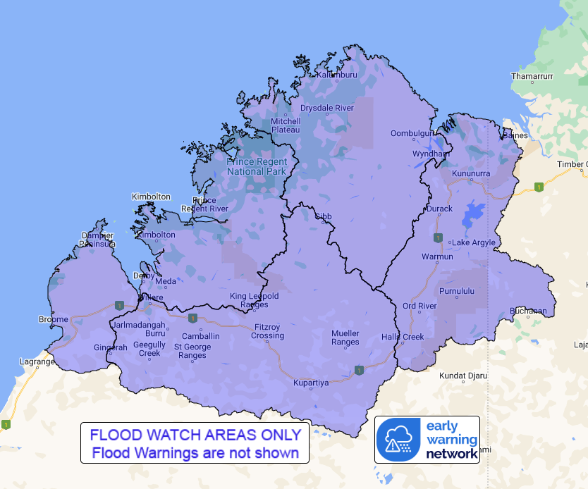
Flood Watch Number: 5
FLOODING POSSIBLE IN PARTS OF THE KIMBERLEY AND FITZROY
RIVERS
Ex-Tropical Cyclone Lincoln is currently located near Kuri Bay.
The system will move west to northwest moving offshore during
today.
Rainfall totals of up to 121mm have been observed over the Flood
Watch area in the 24 hours to 9:00 am Wednesday. Catchments remain
relatively saturated due to the recent rainfall and are likely to
respond relatively quickly to further heavy rainfall.
Rain and thunderstorms are forecast for today and Thursday over
the north and northwest Kimberley. Showers and thunderstorms are
forecast over the remaining Kimberley. Widespread daily rainfall
totals of 20-40 mm are forecast during Wednesday and Thursday, with
isolated heavy falls up to 100 mm possible.
River and creek levels are likely to remain elevated across the
Flood Watch area and further rises are likely with heavy rainfall,
with flooding possible across parts of the Flood Watch area.
Localised flooding and transport disruptions are likely to persist
for the next few days. Many roads, and possibly primary and
secondary highways may be affected. Some communities and homesteads
may become isolated. Check road conditions before travelling.
Catchments likely to be affected include:
East Kimberley Rivers
North Kimberley Rivers
West Kimberley Rivers
Fitzroy River
Flooding is no longer expected across the Sturt Creek District.
However, river and creek levels may remain elevated for the next
few days and roads may be affected.
This flood watch is available by dialling 1300 659 213. For more
information on the Flood Watch Service visit
http://www.bom.gov.au/water/floods/floodWarningServices.shtml
Flood Safety Advice:
DFES advises people and communities to be aware that flooding is
possible and be prepared to relocate equipment and livestock. Watch
water levels. Travellers need to be aware that road conditions may
be adversely affected and travel plans may need to be reconsidered.
Do not drive into water of unknown depth and velocity.
Community information is available from DFES at
www.emergency.wa.gov.au/
Current river levels are available from Department of Water and
Environmental Regulation at
www.water.wa.gov.au/maps-and-data/monitoring/river-level-monitoring
Rainfall and River
Conditions Map
21/Feb/2024 04:04 AM


