
Source: Bureau of Meteorology
Issued at 1:03 pm WST on Sunday 3 March 2024
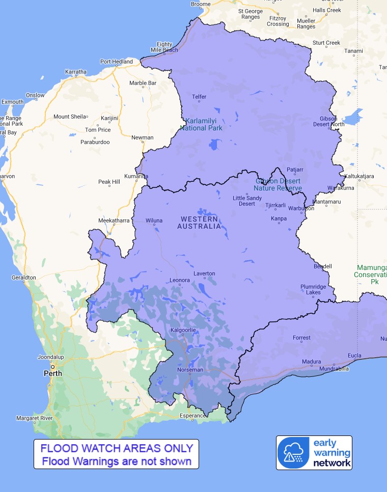
Flood Watch Number: 2
ISOLATED FLOODING POSSIBLE IN THE SALT LAKE AND NULLARBOR DISTRICT
RIVERS AND SANDY DESERT FROM TUESDAY
Heavy rain with showers and thunderstorms is forecast across the
Flood Watch area from Monday.
Catchments are moderately dry in the Flood Watch area.
Widespread daily rainfall totals between 20 - 40 mm with isolated
heavier totals up to around 50 - 60 mm are forecast for Monday.
Further widespread daily totals of 20 - 50 mm, with isolated totals
up to about 60 - 80 mm are forecast during Tuesday. Further rain is
forecast for most of the coming week.
Significant river, creek, and stream rises are likely with heavy
rainfall, with flooding and overland inundation possible across
parts of the Flood Watch area.
Many roads, and possibly primary and secondary highways may be
affected. Some communities and homesteads may become isolated.
Check road conditions before travelling.
Catchments likely to be affected include:
Nullarbor District Rivers
Salt Lakes District Rivers
Sandy Desert
This flood watch is available by dialling 1300 659 213. For more
information on the Flood Watch Service visit
http://www.bom.gov.au/water/floods/floodWarningServices.shtml
Flood Safety Advice:
DFES advises people and communities to be aware that flooding is
possible and be prepared to relocate equipment and livestock. Watch
water levels. Travellers need to be aware that road conditions may
be adversely affected and travel plans may need to be reconsidered.
Do not drive into water of unknown depth and velocity.
Community information is available from DFES at
www.emergency.wa.gov.au/
Current river levels are available from Department of Water and
Environmental Regulation at
www.water.wa.gov.au/maps-and-data/monitoring/river-level-monitoring
Rainfall and River
Conditions Map

03/Mar/2024 05:29 AM


