Source: Bureau of Meteorology
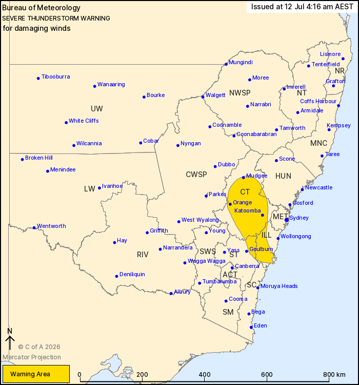
For people in parts of Illawarra, Central Tablelands, Southern
Tablelands, Hunter, South Coast and Central West Slopes and Plains
Forecast Districts.
Issued at 4:16 am Sunday, 12 July 2026.
Isolated damaging winds about a line of showers and isolated
thunderstorms overnight tonight.
Weather Situation: A cold front is crossing southern and central
New South Wales early this morning to produce a line of showers and
isolated thunderstorms with possible damaging winds.
Severe thunderstorms are possible to produce damaging winds in the
warning area over the next several hours. Locations which may be
affected include Orange, Nowra, Mudgee, Katoomba, Bowral, Bathurst,
Huskisson, Glen Davis and Lithgow.
Severe thunderstorms are no longer occurring in the South West
Slopes and Snowy Mountains districts and the warning for these
districts is CANCELLED.
The State Emergency Service advises that people should:
* Park your car under secure cover and away from trees, powerlines
and drains.
* Secure or put away loose items around your house, yard and
balcony.
* Keep at least 8 metres away from fallen power lines or objects
that may be energised, such as fences.
* Report fallen power lines to either Ausgrid (131 388), Endeavour
Energy (131 003), Essential Energy (132 080) or Evoenergy (131 093)
as shown on your power bill.
* Stay indoors away from windows, and keep children and pets
indoors as well.
For emergency help in flood and storms, ring the SES on 132
500.
Stay updated on the Hazards Near Me NSW app or the ACT ESA website
(https://esa.act.gov.au).
11/Jul/2026 06:22 PM