
Source: Bureau of Meteorology
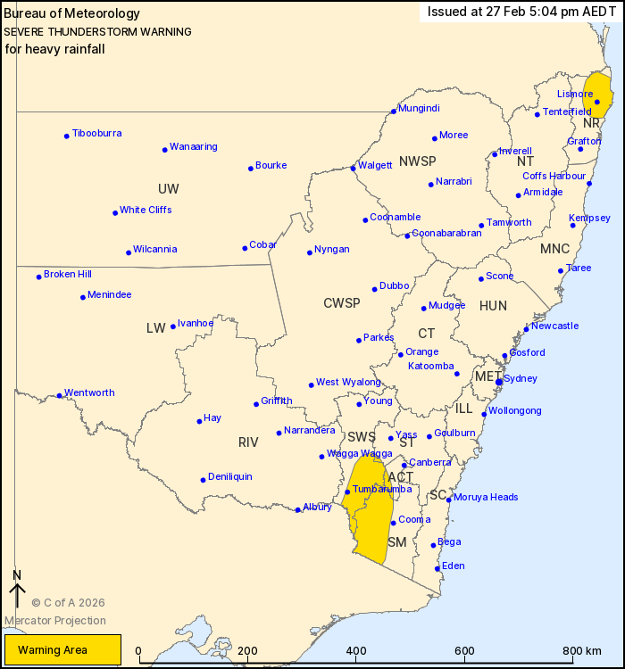
For people in parts of Northern Rivers, South West Slopes, Snowy
Mountains, Australian Capital Territory and Southern Tablelands
Forecast Districts.
Issued at 5:04 pm Friday, 27 February 2026.
Heavy falls continuing in the Northern Rivers and the Snowy
Mountains.
Weather Situation: An easterly moist onshore flow is forcing
persistent showers and thunderstorms about the Northern Rivers this
afternoon. Meanwhile, slow-moving heavy thunderstorms have also
triggered about the Snowy Mountains.
Severe thunderstorms are likely to produce heavy rainfall that may
lead to flash flooding in the warning area over the next several
hours. Locations which may be affected include Lismore, Tumbarumba,
Murwillumbah, Byron Bay, Ballina, Casino, Kyogle, Mullumbimby,
Coraki, Alstonville, Brunswick Heads and Numinbah.
Intense falls have eased over the Northern Rivers but the
situation will be monitored.
Severe thunderstorms are no longer occurring in the Riverina
district and the warning for this district is CANCELLED.
110 mm of RAINFALL HAS BEEN RECORDED AT TUCKURIMBA (LISMORE) IN
THE 3 HRS TO 3:15 PM.
68.6 mm of rainfall has been recorded at Green Pigeon in the hour
to 1:13 pm.
The State Emergency Service advises that people should:
* Keep clear of creeks and storm drains.
* Don't walk, ride your bike or drive through flood water.
* If you are trapped by flash flooding, seek refuge in the highest
available place and ring 000 if you need rescue.
* Stay indoors away from windows, and keep children and pets
indoors as well.
For emergency help in flood and storms, ring the SES on 132
500.
Stay updated on the Hazards Near Me NSW app or the ACT ESA website
(https://esa.act.gov.au).
27/Feb/2026 06:11 AM

