
Source: Bureau of Meteorology
For people in parts of Upper Western Forecast District.
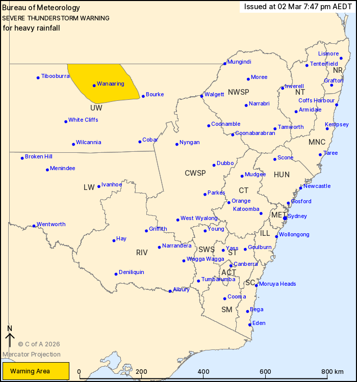
Issued at 7:47 pm Monday, 2 March 2026.
Severe thunderstorms with heavy rainfall over the Upper
Western.
Weather Situation: A moist and unstable airmass combines with a
cold front through the Upper Western to produce slow-moving severe
thunderstorms this evening.
Severe thunderstorms are likely to produce heavy rainfall that may
lead to flash flooding in the warning area over the next several
hours. Locations which may be affected include Wanaaring and Fords
Bridge.
A separate Severe Weather Warning for heavy, locally intense
rainfall is current at time of issue for Southern Tablelands, South
West Slopes, Riverina, Australian Capital Territory and parts of
Central Tablelands, Central West Slopes and Plains, Lower Western,
Upper Western and Snowy Mountains Forecast Districts. Please check
https://www.bom.gov.au/weather-and-climate/warnings-and-alerts for
more information.
The State Emergency Service advises that people should:
* Keep clear of creeks and storm drains.
* Don't walk, ride your bike or drive through flood water.
* If you are trapped by flash flooding, seek refuge in the highest
available place and ring 000 if you need rescue.
* Stay indoors away from windows, and keep children and pets
indoors as well.
For emergency help in flood and storms, ring the SES on 132
500.
Stay updated on the Hazards Near Me NSW app or the ACT ESA website
(https://esa.act.gov.au).
02/Mar/2026 08:51 AM

