
Source: Bureau of Meteorology
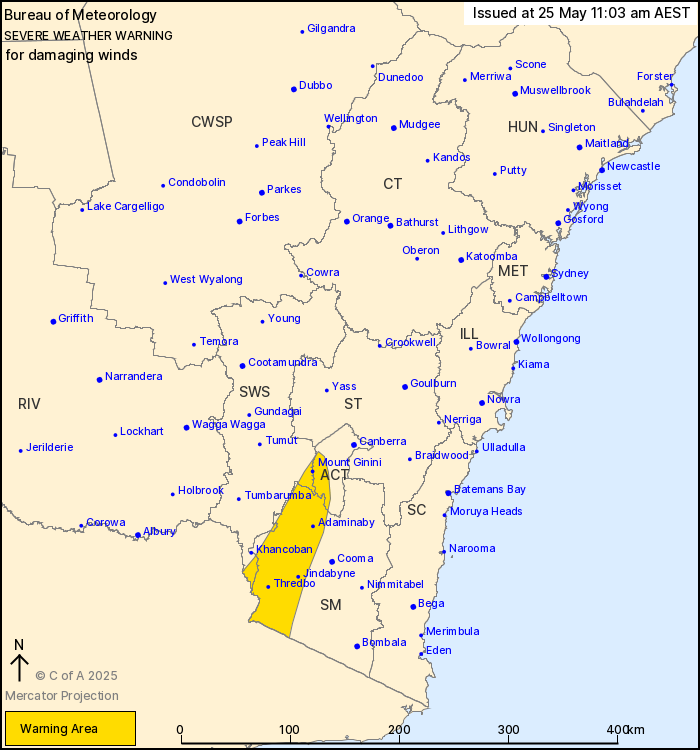
For people in parts of Lower Western, Snowy Mountains, Australian
Capital Territory and South West Slopes Forecast Districts.
Issued at 10:55 am Sunday, 25 May 2025.
Damaging winds redeveloping from early Monday morning.
Weather Situation: Northwesterly winds will strengthen during
early Monday ahead of a strong cold front, expected to bring windy
conditions across the southeast of the state.
FOR SNOWY MOUNTAINS and ACT RANGES above 1400 metres: DAMAGING
WINDS averaging 60 to 70 km/h with peak gusts of around 100 km/h
are expected to develop from early Monday morning, strengthening
through the day.
FOR ALPINE AREAS above 1900 metres: DAMAGING WINDS averaging 80 to
90 km/h with peak gusts of around 125 km/h are expected to
redevelop from early Monday morning, strengthening through the
day.
Locations which may be affected include Wentworth, Charlotte Pass,
Thredbo Top Station, Cabramurra, Selwyn and Adaminaby.
91 km/h mean winds were recorded at Thredbo at 8:51 pm
Saturday.
The State Emergency Service advises that people should:
* Move vehicles under cover or away from trees.
* Secure or put away loose items around your house, yard and
balcony.
* Keep at least 8 metres away from fallen power lines or objects
that may be energised, such as fences.
* Trees that have been damaged by fire are likely to be more
unstable and more likely to fall.
* Report fallen power lines to either Ausgrid (131 388), Endeavour
Energy (131 003), Essential Energy (132 080) or Evoenergy (131 093)
as shown on your power bill.
* Stay vigilant and monitor conditions. Note that the landscape
may have changed following bushfires.
* For emergency help in floods and storms, ring your local SES
Unit on 132 500.
25/May/2025 01:29 AM


