
Source: Bureau of Meteorology
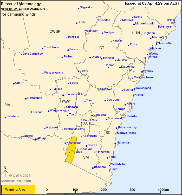
For people in parts of Snowy Mountains Forecast District.
Issued at 4:29 pm Wednesday, 8 April 2026.
Damaging winds for elevated parts of the alpine area from Thursday
evening.
Weather Situation: Northwesterly winds aloft will increase on
Thursday evening ahead of an approaching cold front.Winds will
begin to ease and tend westerly following the passage of the front
in the afternoon.
For the SNOWY MOUNTAINS above 1400 metres: DAMAGING NORTHWESTERLY
WINDS averaging 60 to 70 km/h with peak gusts around 100 km/h are
likely to develop from late Thursday evening.
For areas above 1900 metres: DAMAGING NORTHWESTERLY WINDS
averaging 80 to 90 km/h are likely to develop on Thursday
evening.
Winds are expected to ease in the Snowy Mountains early on Friday
afternoon.
Locations which may be affected include Thredbo, Perisher Valley
and Charlotte Pass.
The State Emergency Service advises that people should:
* Park your car under secure cover and away from trees, powerlines
and drains.
* Secure or put away loose items around your house, yard and
balcony.
* Keep at least 8 metres away from fallen power lines or objects
that may be energised, such as fences.
* Report fallen power lines to either Ausgrid (131 388), Endeavour
Energy (131 003), Essential Energy (132 080) or Evoenergy (131 093)
as shown on your power bill.
For emergency help in flood and storms, ring the SES on 132
500.
Stay updated on the Hazards Near Me NSW app or the ACT ESA website
(https://esa.act.gov.au).
08/Apr/2026 06:42 AM

