
Source: Bureau of Meteorology
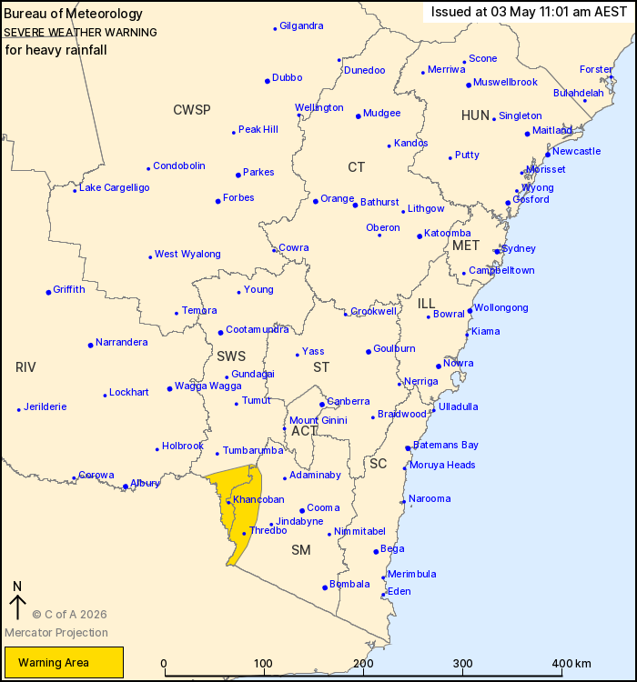
For people in parts of South West Slopes and Snowy Mountains
Forecast Districts.
Issued at 11:01 am Sunday, 3 May 2026.
Heavy rainfall developing about alpine areas Sunday evening.
Weather Situation: A cold front and associated upper-level
disturbance will traverse eastern Victoria and southern New South
Wales overnight Sunday into Monday. A cloud band continues to
develop with rich atmospheric moisture and embedded thunderstorms
with this cold front, leading to the risk of heavy rainfall over
alpine areas overnight.
HEAVY RAINFALL which may lead to FLASH FLOODING is forecast for
the alpine areas of the Snowy Mountains and South West Slopes and
Plains districts from Sunday evening. Six-hourly rainfall totals up
to 70 mm are possible. 24-hourly rainfall totals between 60 and 80
mm are likely, with higher falls to 110 mm possible. HEAVY RAINFALL
should ease below warning thresholds early Monday morning.
Severe thunderstorms with HEAVY RAINFALL and DAMAGING WIND GUSTS
are possible across parts of Riverina, South West Slopes, Central
West Slopes and Plains, and Snow Mountains districts this afternoon
and evening. Severe Thunderstorm Warnings will be issued as
required.
Locations which may be affected include Perisher Valley, Charlotte
Pass, Thredbo, Cabramurra, Selwyn and Khancoban.
The State Emergency Service advises that people should:
* Don't drive, ride or walk through flood water.
* Keep clear of creeks and storm drains.
* If you are trapped by flash flooding, seek refuge in the highest
available place and ring 000 if you need rescue.
For emergency help in flood and storms, ring the SES on 132
500.
Stay updated on the Hazards Near Me NSW app or the ACT ESA website
(https://esa.act.gov.au).
03/May/2026 01:08 AM

