
Source: Bureau of Meteorology
Issued at 11:07 am CST on Sunday 25 May 2025
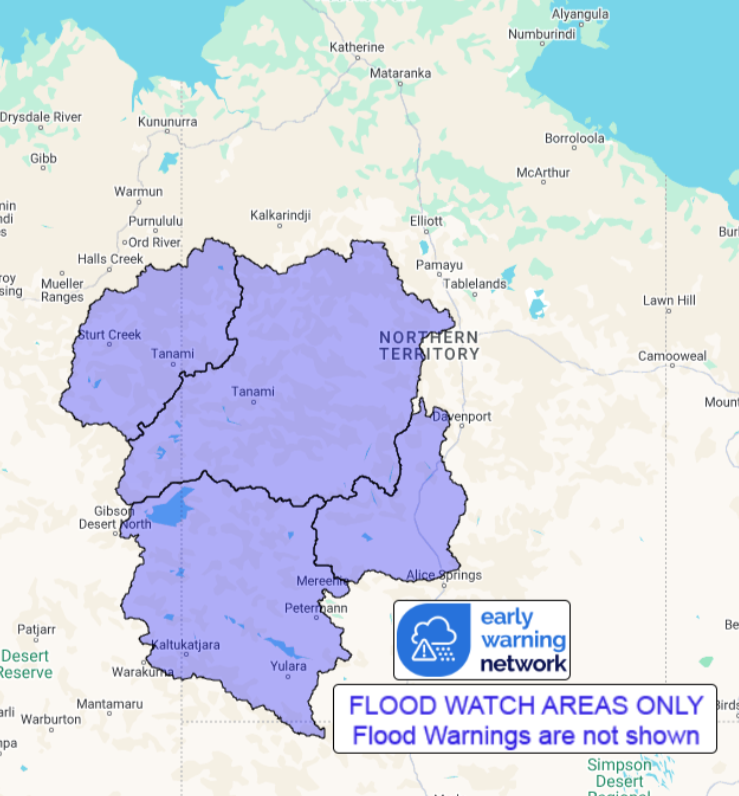
Flood Watch Number: 1
STREAM LEVEL RISES AND LOCALISED FLOODING POSSIBLE ACROSS THE
FLOOD WATCH AREA FROM MONDAY
A surface trough will move east across the south of Northern
Territory during Sunday and Monday and will be accompanied by a
rain band that will persist for several days. This will bring
unseasonal rainfall over the central and southern districts from
Sunday evening.
Catchments in the Flood Watch area are generally dry.
Unseasonal moderate to heavy falls are possible from Sunday
evening. Widespread rainfall totals of up to 100 mm, with isolated
totals of up to 150 mm are forecast over the Flood Watch area from
Monday to Wednesday. The highest rainfall is likely to occur on
Tuesday.
Stream level rises, localised flooding, and overland inundation
are possible in parts of the Flood Watch area, which may affect
road access. Some communities may become isolated.
Check road conditions before travelling.
Catchments likely to be affected include:
Tanami Desert
Central Desert
Western Desert
Sturt Creek District
See www.bom.gov.au/australia/warnings to view all of the Bureau's
current warning products.
More information on the Flood Watch Service and maps of Flood
Watch areas are available at
http://www.bom.gov.au/water/floods/floodWarningServices.shtml
Flood Safety Advice:
The Northern Territory Emergency Service advises that people
should:
* Stay away from flooded drains, rivers, streams and
waterways.
* Prepare for flooding and move away while safe to do so.
* Don't drive into floodwaters.
For emergency help in floods, storms and cyclones call 132
500.
Emergency information is available at www.securent.nt.gov.au
.
The latest road conditions are available at
www.roadreport.nt.gov.au .
Rainfall and River
Conditions Map
25/May/2025 02:29 AM


