
Source: Bureau of Meteorology
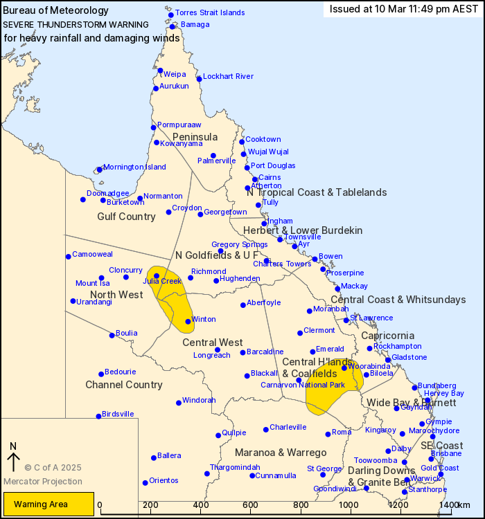
For people in parts of Northern Goldfields and Upper Flinders,
North West, Central Highlands and Coalfields, Central West,
Capricornia and Maranoa and Warrego Forecast Districts.
Issued at 11:49 pm Monday, 10 March 2025.
Severe thunderstorms are continuing across parts of the
state.
Weather Situation: Slow-moving storms in an extremely moist
atmosphere are continuing to produce heavy rainfall across eastern
portions of the state. Storms in the northwest of the state
continue to pose a wind threat.
Severe thunderstorms are likely to produce heavy rainfall that may
lead to flash flooding over the next several hours in parts of the
Central Highlands and Coalfields, Capricornia and Maranoa and
Warrego districts. Locations which may be affected include
Rolleston, Baralaba, Woorabinda, Theodore and Moura.
Severe thunderstorms are likely to produce damaging winds over the
next several hours in parts of the Northern Goldfields and Upper
Flinders, North West and Central West districts. Locations which
may be affected include Winton and Julia Creek.
Severe thunderstorms are no longer occurring in the Wide Bay and
Burnett district and the warning for this district is
CANCELLED.
123 mm RECORDED AT CRACOW IN THE HOUR TO 7:22 PM.
50 mm was recorded at Pine Hills in 30 minutes to 7:06 pm
52.6 mm was recorded at Dooloogarah Alert in the hour to 4:30
pm.
78 mm was recorded at Durah Homestead Alert in the two hours to
3:53 pm.
Emergency services advise people to:
* Park your car undercover away from trees.
* Close doors and windows.
* Keep asthma medications close by. Storms and wind can trigger
asthma attacks.
* Charge mobile phones and power banks in case the power goes
out.
* Put your pets somewhere safe and make sure they can be
identified in case they get lost.
* Do not drive now unless you have to because conditions are
dangerous.
* Tell friends, family and neighbours in the area.
* Go inside a strong building now. Stay inside until the storm has
passed.
10/Mar/2025 01:56 PM


