
Source: Bureau of Meteorology
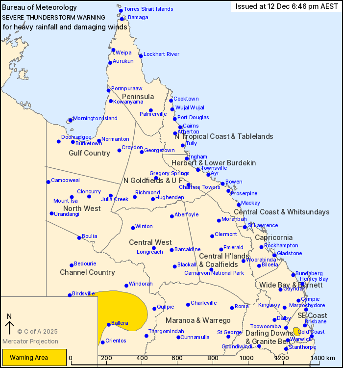
For people in parts of Channel Country and Southeast Coast
Forecast Districts.
Issued at 6:46 pm Friday, 12 December 2025.
Severe thunderstorms in the far southeast and southwest of the
state.
Weather Situation: A very hot and dry airmass in the southwest is
producing gusty thunderstorms. Slow moving thunderstorms have
developed in the Scenic Rim in a humid and unstable airmass.
Severe thunderstorms are likely to produce damaging winds over the
next several hours in parts of the Channel Country district.
Locations which may be affected include Eromanga, Nappa Merrie and
Mt Howitt Station.
Thunderstorms are likely to produce heavy rainfall that may lead
to flash flooding over the next several hours in parts of the
Southeast Coast district. Locations which may be affected include
Laidley.
Severe thunderstorms are no longer occurring in the Gulf Country
and North West districts and the warning for these districts is
CANCELLED.
100 km/h wind gust was recorded at Moomba (SA) at 6:47 pm.
98 km/h wind gust was recorded at Mount Isa Airport at 3:19
pm.
Emergency services advise people to:
* Park your car undercover away from trees.
* Close doors and windows.
* Keep asthma medications close by. Storms and wind can trigger
asthma attacks.
* Charge mobile phones and power banks in case the power goes
out.
* Put your pets somewhere safe and make sure they can be
identified in case they get lost.
* Do not drive now unless you have to because conditions are
dangerous.
* Tell friends, family and neighbours in the area.
* Go inside a strong building now. Stay inside until the storm has
passed.
12/Dec/2025 08:52 AM

