
Source: Bureau of Meteorology
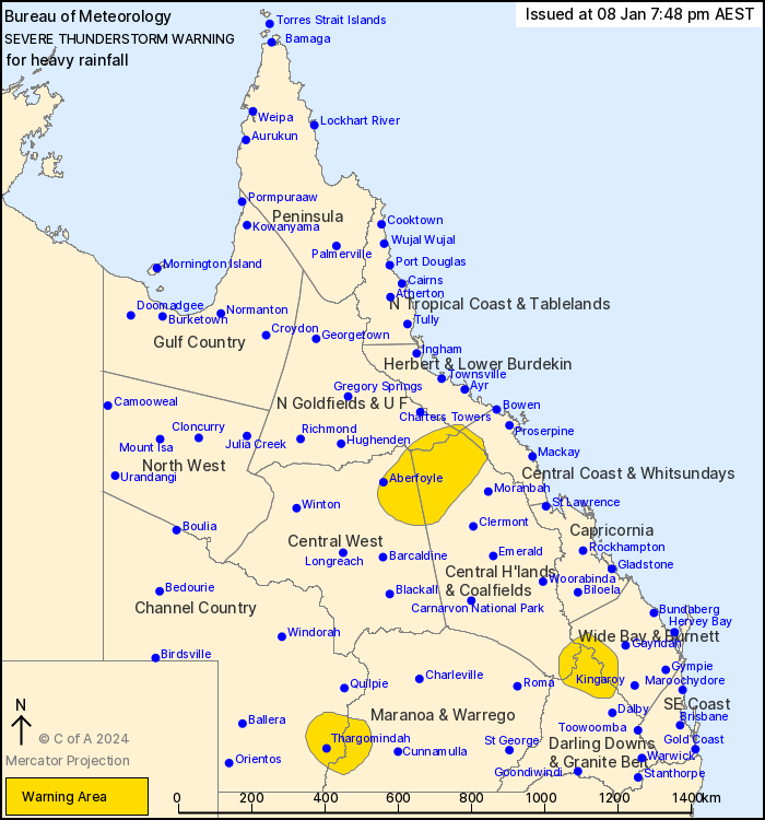
For people in parts of Northern Goldfields and Upper Flinders,
Herbert and Lower Burdekin, Central Coast and Whitsundays, Central
Highlands and Coalfields, Central West, Channel Country, Wide Bay
and Burnett, Maranoa and Warrego and Darling Downs and Granite Belt
Forecast Districts.
Issued at 7:48 pm Monday, 8 January 2024.
Heavy rain with thunderstorms.
Weather Situation: A trough of low pressure and a very moist,
unstable atmosphere are producing severe thunderstorms inland and
around the Gold Coast Hinterland.
Severe thunderstorms are likely to produce heavy rainfall that may
lead to flash flooding in the warning area over the next several
hours. Locations which may be affected include Thargomindah, Natal
Downs, Elgin Downs and Aberfoyle.
Severe thunderstorms are no longer occurring in the Southeast
Coast district and the warning for this district is
CANCELLED.
Cliffdale recorded 38 mm in the 30 minutes to 11.54 am.
Clagiraba Road has recorded 96.0 mm in the 3 hours to 3.24
pm.
Little Nerang Dam has recorded 86.0 mm in the 3 hours to 3.55
pm.
Clagiraba Rd Alert recorded 98.0 mm in 3 hours to 3:27 pm.
Emergency services advise people to:
* Park your car undercover away from trees.
* Close doors and windows.
* Keep asthma medications close by. Storms and wind can trigger
asthma attacks.
* Charge mobile phones and power banks in case the power goes
out.
* Put your pets somewhere safe and make sure they can be
identified in case they get lost.
* Do not drive now unless you have to because conditions are
dangerous.
* Tell friends, family and neighbours in the area.
* Go inside a strong building now. Stay inside until the storm has
passed.
08/Jan/2024 10:03 AM


