
Source: Bureau of Meteorology
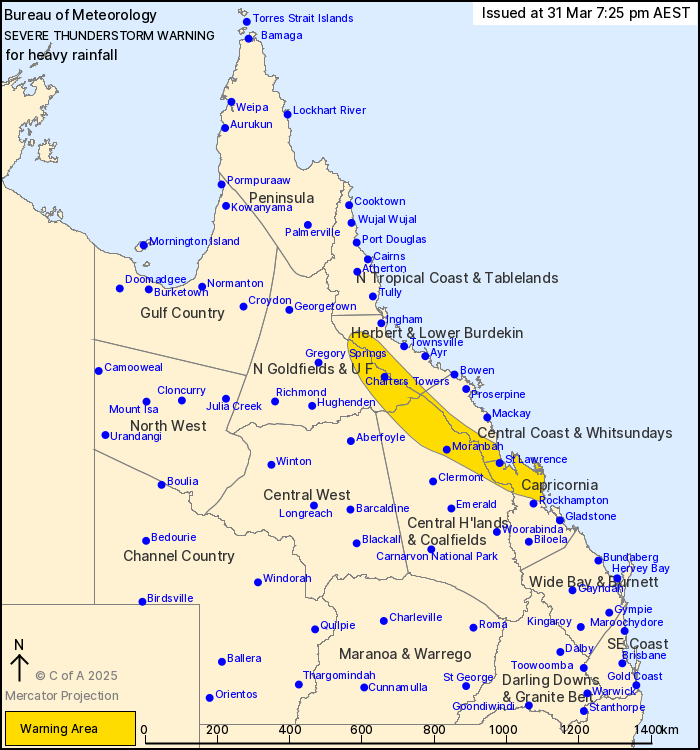
For people in parts of Northern Goldfields and Upper Flinders,
Herbert and Lower Burdekin, Central Coast and Whitsundays, Central
Highlands and Coalfields and Capricornia Forecast Districts.
Issued at 7:25 pm Monday, 31 March 2025.
Heavy rainfall in central and northeastern parts.
Weather Situation: Deep tropical moisture through much of central
and northern Queensland is combining with a trough extending to the
coast from the northwest, producing slow-moving showers and
thunderstorms with heavy rainfall.
Severe thunderstorms are likely to produce heavy rainfall that may
lead to flash flooding in the warning area over the next several
hours. Locations which may be affected include Charters Towers,
Yeppoon, Moranbah, Marlborough, St Lawrence, Nebo, Mingela and
Byfield.
Severe thunderstorms are no longer occurring in the Central West
district and the warning for this district is CANCELLED.
45 mm of rainfall was recorded at Wura in the 30 minutes to 1:37
pm.
64 mm of rainfall was recorded at Mt Joss in 1 hour to 5:52
pm.
Emergency services advise people to:
* Park your car undercover away from trees.
* Close doors and windows.
* Keep asthma medications close by. Storms and wind can trigger
asthma attacks.
* Charge mobile phones and power banks in case the power goes
out.
* Put your pets somewhere safe and make sure they can be
identified in case they get lost.
* Do not drive now unless you have to because conditions are
dangerous.
* Tell friends, family and neighbours in the area.
* Go inside a strong building now. Stay inside until the storm has
passed.
31/Mar/2025 09:33 AM


