
Source: Bureau of Meteorology
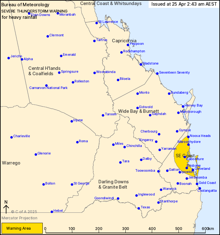
For people in parts of Southeast Coast Forecast District.
Issued at 4:05 am Friday, 25 April 2025.
Severe thunderstorms with heavy rainfall affecting parts of
southeast Queensland this morning.
Weather Situation: A surface trough is combining with an upper
trough to cause thunderstorms and heavy showers in the southeast
this morning.
Severe thunderstorms are likely to produce heavy rainfall that may
lead to flash flooding in the warning area over the next several
hours. Locations which may be affected include Brisbane,
Maroochydore, Moreton Island, Noosa Heads, Beenleigh, Caboolture,
Caloundra, Cleveland, Kilcoy, Nambour, Redcliffe and Samford.
100 mm was recorded in Mapleton in 2 hours to 12:54 am
91 mm was recorded at the Maroochy Intake Weir in 1 hour to 1:00
am
53 mm was recorded in Nambour in 30 minutes to 11:00 pm
Emergency services advise people to:
* Park your car undercover away from trees.
* Close doors and windows.
* Keep asthma medications close by. Storms and wind can trigger
asthma attacks.
* Charge mobile phones and power banks in case the power goes
out.
* Put your pets somewhere safe and make sure they can be
identified in case they get lost.
* Do not drive now unless you have to because conditions are
dangerous.
* Tell friends, family and neighbours in the area.
* Go inside a strong building now. Stay inside until the storm has
passed.
24/Apr/2025 07:28 PM


