
Source: Bureau of Meteorology
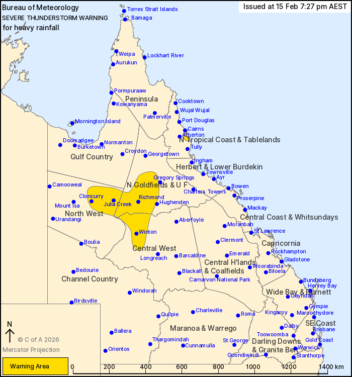
For people in parts of North Tropical Coast and Tablelands,
Northern Goldfields and Upper Flinders, North West and Central West
Forecast Districts.
Issued at 7:27 pm Sunday, 15 February 2026.
Isolated embedded thunderstorms have redeveloped about the North
Tropical Coast near Babinda.
Weather Situation: A broad area of tropical moisture extends over
central and northern parts of the state. A surface trough lies
through inland districts and is a trigger for clusters of
slow-moving thunderstorms that are likely to produce localised
areas of heavy rainfall throughout the evening. Over the North
Tropical coast, isolated severe thunderstorms are embedded in a
broader area of rain causing locally heavy falls in an area between
Cairns and Innisfail.
Severe thunderstorms are likely to produce heavy rainfall that may
lead to flash flooding in the warning area over the next several
hours. Locations which may be affected include Winton, Cloncurry,
Richmond, Julia Creek, Stamford, Gordonvale, Mckinlay, Babinda,
Cloney's Creek and Corfield.
Separate Flood Watches and Warnings are current for multiple parts
of the state at the time of issue. For more information, check
https://www.bom.gov.au/weather-and-climate/warnings-and-alerts
Emergency services advise people to:
* Park your car undercover away from trees.
* Close doors and windows.
* Keep asthma medications close by. Storms and wind can trigger
asthma attacks.
* Charge mobile phones and power banks in case the power goes
out.
* Put your pets somewhere safe and make sure they can be
identified in case they get lost.
* Do not drive now unless you have to because conditions are
dangerous.
* Tell friends, family and neighbours in the area.
15/Feb/2026 09:35 AM

