
Source: Bureau of Meteorology
For people in parts of Channel Country Forecast District.
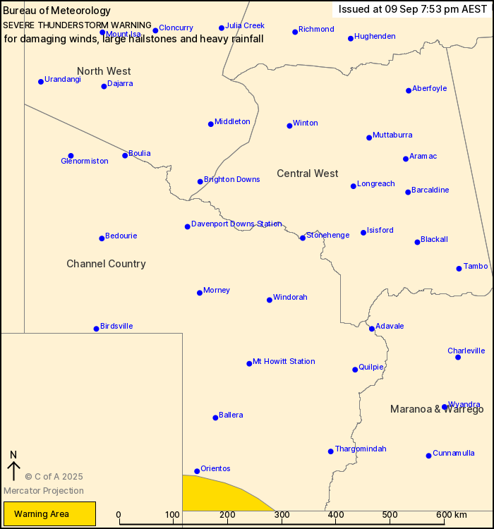
Issued at 7:53 pm Tuesday, 9 September 2025.
Severe thunderstorms moving into the far southwest of Queensland
this evening.
Weather Situation: A low pressure system over western New South
Wales extends a cold front through northeast South Australia,
resulting in severe thunderstorms entering the far southwest of the
State this evening.
Severe thunderstorms are likely to produce damaging winds, large
hailstones and heavy rainfall that may lead to flash flooding in
the warning area over the next several hours.
Emergency services advise people to:
* Park your car undercover away from trees.
* Close doors and windows.
* Keep asthma medications close by. Storms and wind can trigger
asthma attacks.
* Charge mobile phones and power banks in case the power goes
out.
* Put your pets somewhere safe and make sure they can be
identified in case they get lost.
* Do not drive now unless you have to because conditions are
dangerous.
* Tell friends, family and neighbours in the area.
* Go inside a strong building now. Stay inside until the storm has
passed.
09/Sep/2025 09:59 AM


