
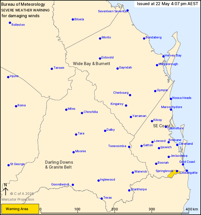
Source: Bureau of Meteorology
For people in parts of Southeast Coast Forecast District.
Issued at 4:07 pm Friday, 22 May 2026.
Damaging winds developing this evening over elevated parts of the
Border Ranges.
Weather Situation: A deep low pressure system offshore is driving
a strong southerly airstream over the southeast of the state. Winds
will increase over the elevated terrain of the Border Ranges after
sunset as they become trapped beneath a developing inversion. Winds
begin to ease tomorrow morning.
DAMAGING WINDS averaging 55 to 65 km/h with peak gusts of around
90 km/h are likely after sunset and overnight along the elevated
peaks of the Border Ranges. DAMAGING WINDS GUSTS up to 90 km/h are
also a slight possibility this afternoon. These winds will continue
into early tomorrow morning before easing around sunrise.
There may be an increased risk of toppling trees due to soft soil
following recent rain.
Locations which may be affected include Springbrook.
Emergency services advise people to:
* Park your car undercover away from trees.
* Close doors and windows.
* Keep asthma medications close by. Storms and wind can trigger
asthma attacks.
* Charge mobile phones and power banks in case the power goes
out.
* Put your pets somewhere safe and make sure they can be
identified in case they get lost.
* Do not drive now unless you have to because conditions are
dangerous.
* Tell friends, family and neighbours in the area.
* Go inside a strong building now. Stay inside until the storm has
passed.
22/May/2026 06:15 AM

