
Source: Bureau of Meteorology
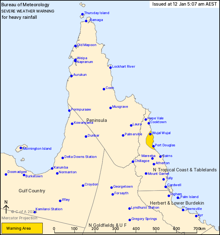
For people in parts of North Tropical Coast and Tablelands
Forecast District.
Issued at 5:07 am Friday, 12 January 2024.
Heavy rainfall developing over parts of the northeast tropical
coast between Port Douglas and Wujal Wujal.
Weather Situation: A local area of convergence associated with the
monsoon trough is currently located over coastal areas of the
northeast tropical coast. This system is forecast to remain
slow-moving during today.
HEAVY RAINFALL which may lead to FLASH FLOODING is developing
between an area from Port Douglas to Daintree, possibly extending
northwards to Wujal Wujal by late morning. Six-hourly rainfall
totals between 140 and 180 mm are possible.
The HEAVY RAIN risk will ease during this afternoon and
evening.
Locations which may be affected include Port Douglas, Mossman,
Wujal Wujal and Daintree Village.
Emergency services advise people to:
* Park your car undercover away from trees.
* Close doors and windows.
* Keep asthma medications close by. Storms and wind can trigger
asthma attacks.
* Charge mobile phones and power banks in case the power goes
out.
* Put your pets somewhere safe and make sure they can be
identified in case they get lost.
* Do not drive now unless you have to because conditions are
dangerous.
* Tell friends, family and neighbours in the area.
* Go inside a strong building now. Stay inside until the storm has
passed.
11/Jan/2024 07:21 PM


