
Source: Bureau of Meteorology
For people in parts of North West and Channel Country Forecast
Districts.
Issued at 10:50 am Friday, 27 February 2026.
Heavy rainfall continues in the far southwest of the state.
Weather Situation: A slow-moving tropical low located over
southern parts of the Northern Territory is expected to move slowly
to the west today. Rich tropical moisture surrounding this system
is feeding into a broad, near stationary trough in the southwest of
the state, with persistent rain areas and thunderstorm activity
likely to continue throughout the day. Rainfall is expected to ease
by this evening as the low moves further west.
HEAVY RAINFALL which may lead to FLASH FLOODING is likely, with
six hour rainfall totals between 40 and 80 mm possible.
These conditions also threaten cattle and other livestock.
The risk of widespread heavy falls is likely to clear from the
southwest of the state later on Friday. Isolated heavy rainfall
remains possible about northwestern and far western Queensland with
Severe Thunderstorm Warnings to be issued if required.
Separate Flood Watches and/or Warnings are current at the time of
issue. Please refer to
https://www.bom.gov.au/weather-and-climate/warnings-and-alerts/ for
more information.
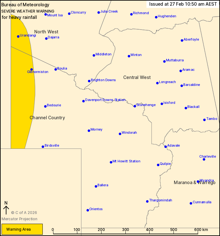
Locations which may be affected include Urandangi and
Glenormiston.
Severe weather is no longer occurring in the Central West district
and the warning for this district is CANCELLED.
Emergency services advise people to:
* Park your car undercover away from trees.
* Close doors and windows.
* Keep asthma medications close by. Storms and wind can trigger
asthma attacks.
* Charge mobile phones and power banks in case the power goes
out.
* Put your pets somewhere safe and make sure they can be
identified in case they get lost.
* Do not drive now unless you have to because conditions are
dangerous.
* Tell friends, family and neighbours in the area.
* Go inside a strong building now. Stay inside until the storm has
passed.
27/Feb/2026 12:58 AM

