
Source: Bureau of Meteorology
Issued at 1:17 pm ACDT on Sunday 1 March 2026
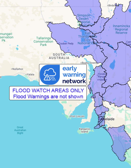
Flood Watch Number: 10
Warning number is out of sequence due to recovery from technical
issues
FLOODING CONTINUING IN PARTS OF NORTH-EASTERN AND CENTRAL
CATCHMENTS
WIDESPREAD RIVERINE FLOODING NO LONGER LIKELY ACROSS THE MID
NORTH, MOUNT LOFTY RANGES, AND THE ADELAIDE METROPOLITAN AREA
A tropical low pressure system over the north of SA extends a
trough southwards, increasing the risk of heavy, locally intense
falls, particularly about the far east of the state later today.
Showers, thunderstorms and areas of rain over eastern border
districts are forecast to contract eastwards during Monday,
clearing by the evening.
The highest rainfall totals during Sunday and Monday are forecast
across the eastern Flinders, eastern Mid North, southern North East
Pastoral and Riverland forecast districts, with flooding possible
in these areas. Lower rainfall totals are now forecast across
southern parts of the Mid North, the Mount Lofty Ranges, and the
Adelaide metropolitan area, with widespread flooding no longer
likely in these areas. However these areas remain within the Flood
Watch primarily to cover the risk of isolated minor flooding and
flash flooding.
The highest rainfall totals over the past week have been observed
over the North East Pastoral and Flinders districts, and Eyre
Peninsula, with the highest falls over the last 24 hours to late
morning Sunday over eastern parts of the state.
River and creek level rises, localised flooding, and overland
inundation are occurring across parts of the Flood Watch area and
are likely to become more extensive, particularly across
far-eastern parts of the Flood Watch area. Many bitumen and dirt
outback roads are currently impacted by flooding, resulting in the
isolation of some communities. The majority of major roads in the
region are closed. Check road conditions before travelling.
Catchments likely to be affected include:
Limestone and Millicent Coast Rivers and Creeks
River Murray in SA
Angas and Bremer Rivers
Danggali Rivers and Creeks
Fleurieu Peninsula
Onkaparinga River
Torrens and metropolitan rivers and creeks
Gawler River
Light and Wakefield Rivers
Broughton River
Flinders Ranges Rivers and Creeks
Warburton River
Cooper Creek
Lake Eyre
Lake Frome
Simpson Desert
A Severe Weather Warning for heavy, locally intense, rainfall
remains current for parts of the Flood Watch area.
Although rainfall has now eased across the West Coast Rivers and
Creeks, and Eastern Great Victoria Desert, some local impacts may
continue for several days.
For the latest flood and weather warnings see
www.bom.gov.au/weather-and-climate/warnings-and-alerts
For the latest rainfall and river level information see
www.bom.gov.au/australia/flood
Safety Advice:
- Don't drive, walk, swim or play in floodwater because it is
dangerous.
- Stay away from flooded drains, rivers, streams and
waterways.
- Obey road closure signs. Plan ahead so you don't drive on
flooded roads.
- Check the ABC and local media for updates. The situation can
change quickly, so stay informed.
- For local emergency management warnings and advice visit
www.ses.sa.gov.au/incidents-and-warnings/incidents-and-warnings-map/.
For emergency assistance call SES on telephone number 132 500. In
life-threatening emergencies, call 000 (triple zero)
immediately.
Rainfall and River
Conditions Map
01/Mar/2026 03:13 AM

