Source: Bureau of Meteorology
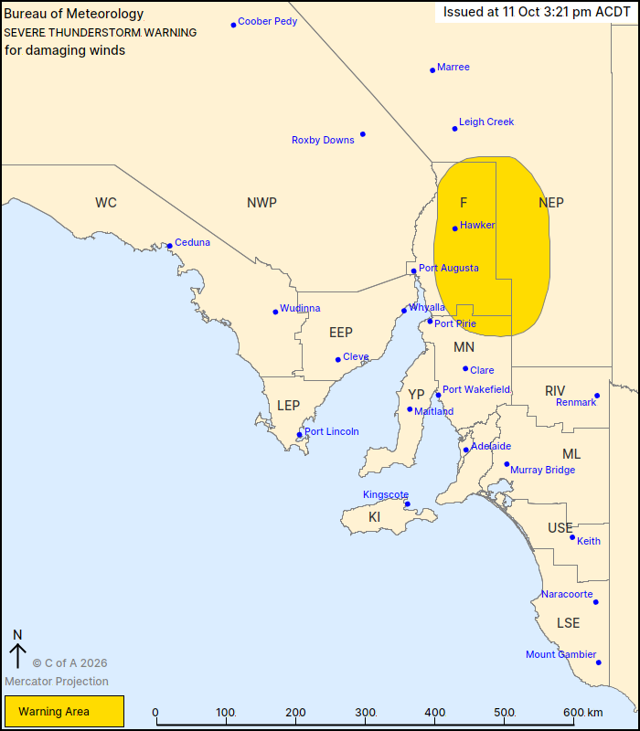
For people in Flinders and parts of Mid North and North East
Pastoral districts.
Issued at 3:21 pm Sunday, 11 October 2026.
Severe thunderstorms are weakening near Adelaide but continuing
around the Flinders Ranges this afternoon.
Weather Situation: A trough over western SA will move eastwards
ahead of a cold front which is forecast to cross the state later
this evening. Increased winds aloft combined with a moist and
unstable airmass means severe thunderstorms are possible this
afternoon.
Severe thunderstorms are likely to produce damaging winds in the
warning area over the next several hours. Locations which may be
affected include Hawker, Jamestown, Peterborough, Melrose and
Parachilna.
Severe thunderstorms are no longer occurring in the Adelaide
Metropolitan, Mount Lofty Ranges, Eastern Eyre Peninsula, Yorke
Peninsula, Murraylands and North West Pastoral districts and the
warning for these districts is CANCELLED.
98 km/h wind gust was recorded at Woomera Airport at 12:18
pm
The State Emergency Service advises that people should:
* Secure or put away loose items around your property.
* Move cars under cover or away from trees.
* Keep clear of fallen power lines.
* Stay indoors, away from windows, while storms are nearby.
11/Oct/2026 05:00 AM