
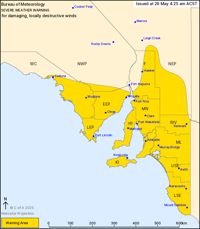
Source: Bureau of Meteorology
For people in Adelaide Metropolitan, Mount Lofty Ranges, Lower
Eyre Peninsula, Eastern Eyre Peninsula, Yorke Peninsula, Flinders,
Mid North, Kangaroo Island, Riverland, Murraylands, Upper South
East, Lower South East and parts of West Coast, North East Pastoral
and North West Pastoral districts.
Issued at 4:25 am Monday, 26 May 2025.
DAMAGING, POSSIBLY DESTRUCTIVE WINDS DEVELOPING OVER SOUTH
AUSTRALIA.
Weather Situation: A vigorous cold front is currently crossing
central parts of the South Australian coast, and will move over
eastern inland areas during the morning. Northwesterly winds will
strengthen ahead of the front, before shifting more westerly behind
it. Conditions will gradually improve on Monday night, with winds
easing by Tuesday morning.
Northwesterly strong to DAMAGING WINDS averaging 60 to 70 km/h
with peak gusts of around 110 km/h are possible for Kangaroo Island
and coastal parts of the West Coast, Lower Eyre Peninsula, Yorke
Peninsula, Fleurieu Peninsula and coastal parts of the far
southeast. Conditions will deteriorate further during the morning
behind the front, with possible DAMAGING WINDS spreading north to
Adelaide and inland parts of the warning area, including elevated
parts of the Flinders district by midday.
Locally DESTRUCTIVE WIND GUSTS with peak gusts in excess of 125
km/h are possible today for parts of the coastal fringe between the
western Eyre Peninsula and the Victoria state border and may cause
SIGNIFICANT DAMAGE TO HOMES AND PROPERTY. Destructive wind gusts
are forecast to ease during the evening.
Damaging winds are forecast to ease below warning thresholds over
inland areas overnight on Monday, and for coastal areas by late
Tuesday morning.
Dry soils bring an increased risk of gusty winds toppling
trees.
A separate Severe Weather Warning for ABNORMALLY HIGH TIDES is
also current for coastal parts of the state. Please refer to
http://www.bom.gov.au/warnings/
Locations which may be affected include Adelaide, Port Lincoln,
Whyalla, Renmark, Mount Gambier and Ceduna.
65 km/h mean winds were recorded at Point Avoid at 9:07 pm
Monday.
The State Emergency Service advises that people should:
* Keep clear of fallen power lines;
* Move vehicles under cover or away from trees;
* Secure or put away loose items around your property.
* Stay indoors, away from windows, while conditions are
severe.
25/May/2025 07:46 PM


