
Source: Bureau of Meteorology
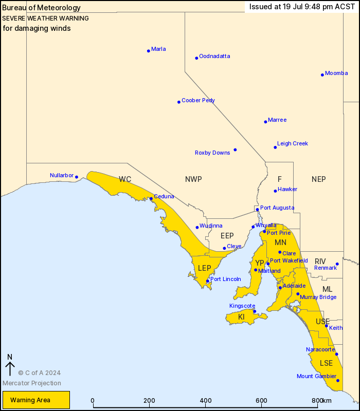
For people in Adelaide Metropolitan, Mount Lofty Ranges, Lower
Eyre Peninsula, Yorke Peninsula, Mid North, Kangaroo Island, Upper
South East, Lower South East and parts of West Coast, Eastern Eyre
Peninsula, Murraylands, Flinders, Riverland and North East Pastoral
districts.
Issued at 9:48 pm Friday, 19 July 2024.
Damaging winds along the Mount Lofty Ranges and parts of the
coastline continuing overnight and into Saturday morning.
Weather Situation: A vigorous west to southwesterly flow in the
wake of a cold front will continue to impact parts of the coastal
fringe and Mount Lofty Ranges through to late Saturday
morning.
For parts of the WEST COAST and EYRE PENINSULA: DAMAGING WINDS
averaging 60 to 70 km/h with gusts of around 100 km/h are likely to
continue for the next several hours, easing during early Saturday
morning.
For KANGAROO ISLAND, FLEURIEU and YORKE PENINSULAS, ADELAIDE, and
parts of the MID NORTH and far SOUTHEAST DISTRICTS: DAMAGING WINDS
averaging 60 to 70 km/h with gusts up to 120 km/h are possible,
particularly with thunderstorms. Winds easing from the west late
Saturday morning.
Locations which may be affected include Adelaide, Port Lincoln,
Mount Gambier, Ceduna, Kingscote and Naracoorte.
106 km/h wind gust recorded at Cummins at 7:30 pm
102 km/h wind gust recorded at Cape Willoughby at 2:07 pm
93 km/hr wind gust recorded at Port Lincoln at 7:52pm
98 km/h wind gust recorded at Warburto Point at 5:51pm, with a 90
km/h gust recorded at 7:41 pm
93 km/h wind gust recorded at Cultana (Defence) at 7:54 pm
The State Emergency Service advises that people should:
* Move vehicles under cover or away from trees;
* Secure or put away loose items around your property.
* Stay indoors, away from windows, while conditions are
severe.
19/Jul/2024 12:32 PM

