
Source: Bureau of Meteorology
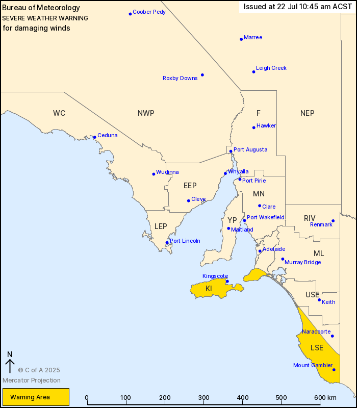
For people in Kangaroo Island, Lower South East and parts of Mount
Lofty Ranges and Upper South East districts.
Issued at 10:45 am Tuesday, 22 July 2025.
Damaging winds continuing over southern parts of the state
today.
Weather Situation: A vigorous west to northwesterly airstream has
developed behind a cold front over southern parts of the state this
morning associated with a low pressure system passing to the
south.
DAMAGING WEST TO NORTHWESTERLY WINDS averaging 55 to 70 km/h with
peak gusts of around 110 km/h remain possible across Kangaroo
Island, the Lower South East, and the Fleurieu Peninsula.
Winds are forecast to ease below warning thresholds about Kangaroo
Island and the Fleurieu Peninsula by late afternoon, and throughout
by late evening.
Locations which may be affected include Mount Gambier, Kingscote,
Victor Harbor, Robe, Millicent and Lucindale.
Severe weather is no longer occurring in the Lower Eyre Peninsula
and Yorke Peninsula districts and the warning for these districts
is CANCELLED.
A 96 km/h gust was recorded at Robe Airfield, with sustained winds
of 72 km/h in the period about 10:22 am.
A 104 km/h gust was recorded at Cape Jaffa, with sustained winds
of 72 km/h in the period about 10:18 am.
A 90 km/h gust was recorded at Cape Willoughby, with sustained
winds of 74 km/h in the period about 3:31 am.
A 94 km/h gust was recorded at Cape Borda (Kangaroo Is) at 02:57
am.
The State Emergency Service advises that people should:
* Move vehicles under cover or away from trees;
* Secure or put away loose items around your property.
* Stay indoors, away from windows, while conditions are
severe.
22/Jul/2025 01:35 AM

