
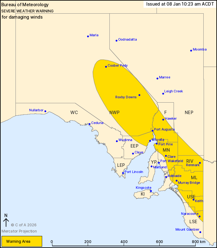
Source: Bureau of Meteorology
For people in Flinders, Mid North, Riverland, Murraylands, Upper
South East and parts of Mount Lofty Ranges, Eastern Eyre Peninsula,
Lower South East, North West Pastoral, Yorke Peninsula and North
East Pastoral districts.
Issued at 10:23 am Thursday, 8 January 2026.
Damaging wind gusts developing across a large part of the state on
Friday.
Weather Situation: Gusty northwesterly winds are expected to
develop from Friday morning, mainly about the Mt Lofty and Flinders
Ranges, while a change moving through the state will produce
broadscale thunderstorm activity increasing the risk more broadly
for damaging wind gusts during the afternoon and early evening.
Conditions will slowly ease during Friday evening.
DAMAGING WIND GUSTS with peak gusts around 90 km/h are possible
after sunrise on Friday morning, mainly about the Mt Lofty Ranges
and Flinders Ranges, extending throughout the warning area during
the afternoon.
DAMAGING WIND GUSTS with peak gusts to 100 km/h are likely with
thunderstorms during the afternoon and early evening.
Winds are expected to ease below thresholds during Friday
evening.
Locations which may be affected include Whyalla, Renmark, Port
Augusta, Port Pirie, Clare and Murray Bridge.
The State Emergency Service advises that people should:
* Move vehicles under cover or away from trees;
* Secure or put away loose items around your property.
* Stay indoors, away from windows, while conditions are
severe.
08/Jan/2026 12:18 AM


