Source: Bureau of Meteorology
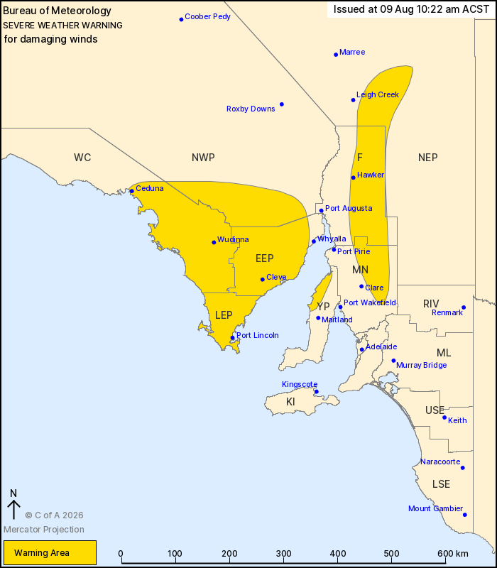
For people in Lower Eyre Peninsula, Eastern Eyre Peninsula and
parts of West Coast, Yorke Peninsula, Flinders, Mid North, North
West Pastoral and North East Pastoral districts.
Issued at 10:22 am Sunday, 9 August 2026.
Damaging winds developing about the Eyre Peninsula, Yorke
Peninsula and Flinders Ranges today.
Weather Situation: A cold front extending from a low-pressure
system in the Bight is moving across the state today, bringing a
gusty west to southwesterly change. A secondary trough will
approach western Eyre Peninsula this afternoon, strengthening winds
for a period.
DAMAGING WINDS averaging 55 to 65 km/h with peak gusts of around
90 km/h are possible about the western and southern Eyre Peninsula
from late Sunday morning. DAMAGING WIND GUSTS of around 90 km/h are
also possible further inland from Sunday afternoon, particularly
over the eastern Eyre Peninsula and northern Yorke Peninsula.
Conditions are forecast to ease below warning thresholds by late
Sunday evening.
DAMAGING WINDS averaging 60 to 70 km/h with peak gusts of around
100 km/h are likely about the Flinders Ranges from late Sunday
afternoon, easing below warning thresholds by around sunrise on
Monday morning.
Locations which may be affected include Port Lincoln, Ceduna,
Wudinna, Cleve, Hawker, Elliston, Jamestown, Kadina, Burra,
Arkaroola, Peterborough and Streaky Bay.
The State Emergency Service advises that people should:
* Move vehicles under cover or away from trees;
* Secure or put away loose items around your property.
* Stay indoors, away from windows, while conditions are
severe.
09/Aug/2026 01:07 AM