Source: Bureau of Meteorology
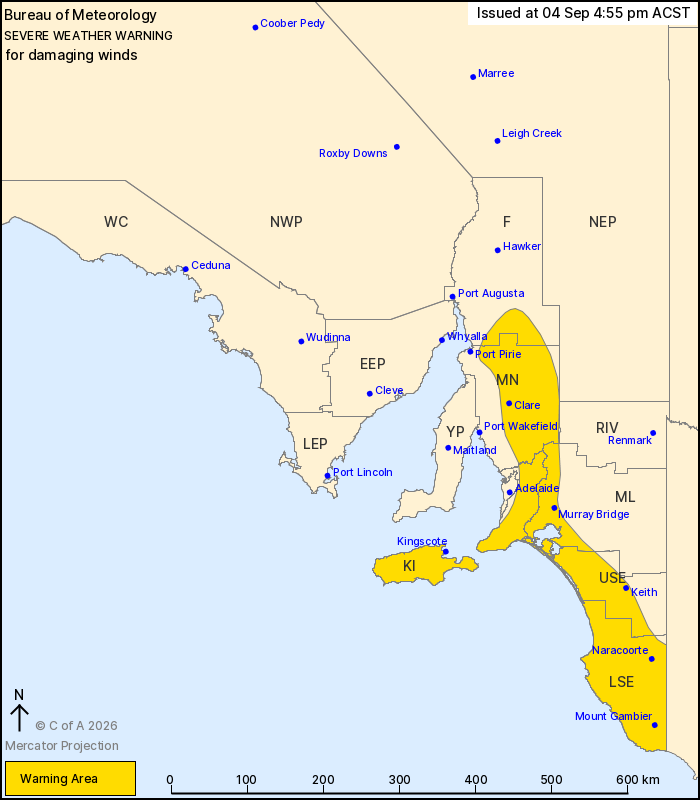
For people in Mount Lofty Ranges, Mid North, Kangaroo Island,
Upper South East, Lower South East and parts of Flinders and
Murraylands districts.
Issued at 4:55 pm Friday, 4 September 2026.
Damaging winds possible over parts of the southeast from early
Saturday morning.
Weather Situation: A strong cold front is crossing the Bight and
will approach southeastern SA tonight. Northwesterly winds will
increase, before winds turn more westerly behind the front early
Saturday morning and ease later in the afternoon.
For KANGAROO ISLAND and parts of the SOUTHEAST: DAMAGING WIND
GUSTS with peak gusts in excess of 90 km/h are possible from early
Saturday morning, most likely in showers and thunderstorms.
DAMAGING WINDS are likely to contract to the Lower South East by
midday and ease by the late afternoon.
For MOUNT LOFTY and FLINDERS RANGES: DAMAGING WESTERLY WINDS
averaging 60 to 70 km/h with peak gusts of around 100 km/h are
likely from early Saturday morning, easing during the late
afternoon.
Locations which may be affected include Mount Gambier, Clare,
Murray Bridge, Kingscote, Naracoorte and Keith.
The State Emergency Service advises that people should:
* Move vehicles under cover or away from trees;
* Secure or put away loose items around your property.
* Stay indoors, away from windows, while conditions are
severe.
04/Sep/2026 07:30 AM