
Source: Bureau of Meteorology
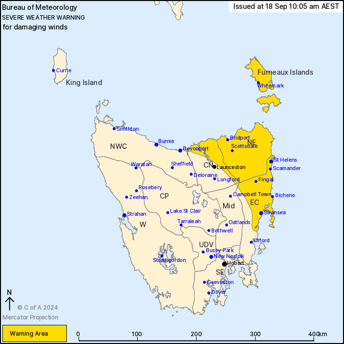
For people in Furneaux Islands, North East and parts of East
Coast, Central North, North West Coast and Midlands Forecast
Districts.
Issued at 10:05 am Wednesday, 18 September 2024.
Damaging winds have developed in the northeast on and ahead of a
cold front this morning.
Weather Situation: Strengthening west to northwesterly winds ahead
of a cold front. The cold front is currently in the southwest of
the state and expected to be near the northeast coast by late
afternoon.
DAMAGING WINDS, averaging 60 to 70 km/h with peak gusts to around
100 km/h are possible about parts of the north and east coasts this
morning. Gusts over elevated terrain may exceed 110 km/h.
DAMAGING WIND GUSTS of around 100 km/h are possible in showers on
and ahead of cold front.
Winds are expected to ease late afternoon.
Locations which may be affected include Scottsdale, Whitemark, St
Helens, Swansea, Bicheno and Fingal.
106 km/h wind gust was recorded at 9:25am at Larapuna.
Sustained 65km/h winds were recorded at Larapuna from 830am.
The State Emergency Service advises that people should:
* Supervise children closely.
* Check that family and neighbours are aware of warnings.
* Manage pets and livestock.
* Secure outdoor items including furniture and play
equipment.
* Be prepared in case of power outages and report any outages to
TasNetworks on 132 004.
* Beware of damaged trees and power lines and take care when
driving.
* Listen to the ABC radio or check www.ses.tas.gov.au for further
advice.
* For emergency assistance contact the SES on 132500.
18/Sep/2024 12:10 AM


