
Source: Bureau of Meteorology
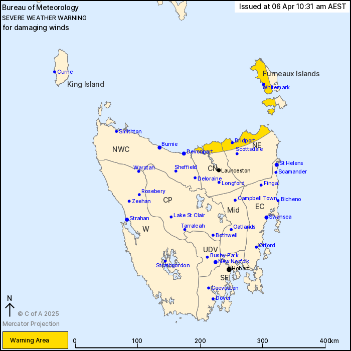
For people in parts of Furneaux Islands, North East and Central
North Forecast Districts.
Issued at 10:31 am Sunday, 6 April 2025.
Damaging winds developing over parts of the northeast.
Weather Situation: A vigorous west to northwesterly airstream
associated with the passage of a cold front that will be crossing
the state today. It is expected to bring damaging winds to coastal
parts of the northeast from late morning and into the afternoon. As
the cold front clears the state during the evening, winds will turn
west-southwesterly and the damaging winds in the northeast will
ease.
Gusty conditions may continue over exposed coastal areas and
elevated terrain into early Monday morning.
Strong to DAMAGING WINDS averaging 60 to 70 km/h with peak gusts
of around 100 km/h are possible about northeastern parts of
Tasmania, including the Furneaux Islands, from late Sunday morning
and are expected to continue for most of the afternoon.
Winds are expected to ease below warning thresholds during the
evening.
Locations which may be affected include George Town, Whitemark and
Bridport.
The State Emergency Service advises that people should:
* Supervise children closely.
* Check that family and neighbours are aware of warnings.
* Manage pets and livestock.
* Secure outdoor items including furniture and play
equipment.
* Be prepared in case of power outages and report any outages to
TasNetworks on 132 004.
* Beware of damaged trees and power lines and take care when
driving.
* Listen to the ABC radio or check www.ses.tas.gov.au for further
advice.
* For emergency assistance contact the SES on 132500.
06/Apr/2025 12:34 AM


