
Source: Bureau of Meteorology
Issued at 11:52 am WST on Tuesday 27 May 2025
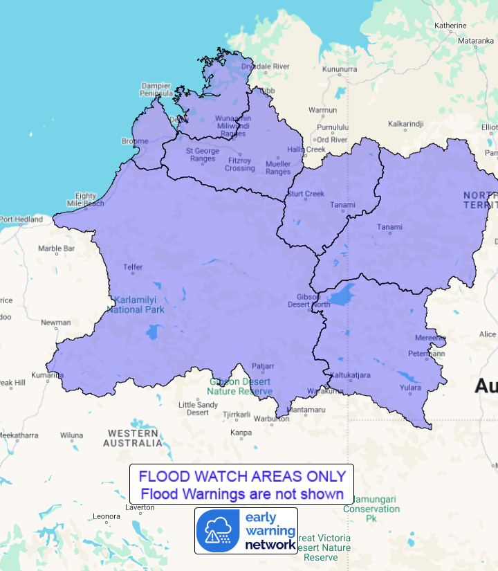
Flood Watch Number: 5
RIVER AND CREEK LEVEL RISES AND LOCALISED FLOODING POSSIBLE ACROSS
THE FLOOD WATCH AREA
A band of rain across northern Western Australia on Tuesday will
continue to bring widespread unseasonal moderate to heavy rainfall
totals to the Flood Watch area before clearing by Wednesday.
Widespread rainfall totals of 50 to 100 mm were recorded across
much of the flood watch area during Monday.
Catchments in the Flood Watch area that have received recent
rainfall are moderately wet, otherwise catchments are relatively
dry.
Further rainfall on Tuesday is expected to sweep across remaining
parts of the flood watch area, resulting in widespread 2 day totals
of around 80 to 100 mm, with isolated totals of up to 150 mm over
the flood watch area.
This rainfall is likely to result in river level rises along with
hazardous road conditions, especially on secondary roads. Some
communities and homesteads may become isolated.
While significant river flooding is not expected, smaller streams
and creeks are likely to rise rapidly and prevent road users from
traversing typically dry areas. Check road conditions before
travelling.
Catchments likely to be affected include:
West Kimberley Rivers
Fitzroy River
Sturt Creek District
Tanami Desert
Western Desert
Sandy Desert
This flood watch is available by dialling 1300 659 213. For more
information on the Flood Watch Service visit
http://www.bom.gov.au/water/floods/floodWarningServices.shtml
Flood Safety Advice:
DFES advises people and communities to be aware that flooding is
possible and be prepared to relocate equipment and livestock. Watch
water levels. Travellers need to be aware that road conditions may
be adversely affected and travel plans may need to be reconsidered.
Do not drive into water of unknown depth and velocity.
Community information is available from DFES at
www.emergency.wa.gov.au/
Current river levels are available from Department of Water and
Environmental Regulation at
www.water.wa.gov.au/maps-and-data/monitoring/river-level-monitoring
Rainfall and River
Conditions Map
27/May/2025 04:00 AM

