
Source: Bureau of Meteorology
Issued at 3:39 am Friday, 27 March 2026.
Damaging wind gusts possible this morning with showers and
thunderstorms around Severe Tropical Cyclone Narelle.
Weather Situation: Severe Tropical Cyclone Narelle is currently
located offshore of the Pilbara and will maintain a
south-southwesterly track as it approaches the Northwest Cape this
morning. Fast moving rainbands on the far eastern flank of the
system may produce gusty conditions over the central Pilbara this
morning.
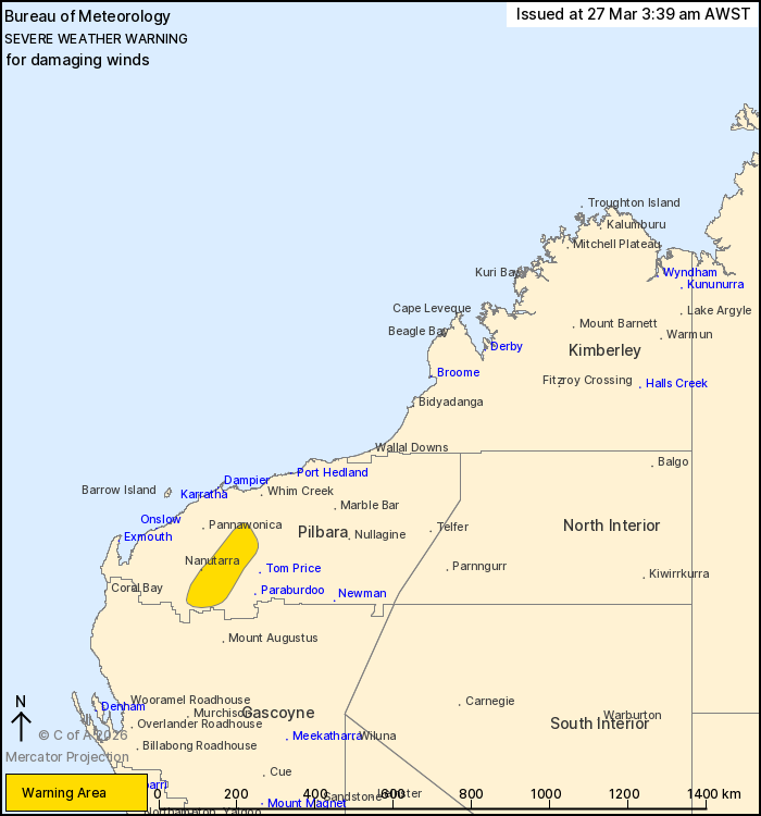
DAMAGING WIND GUSTS with peak gusts of around 90 km/h are possible
in the warning area this morning associated with bands of showers
and thunderstorms around the system. Gusty conditions are likely to
shift southward throughout the day as the system tracks towards the
south-southwest.
A Tropical Cyclone Advice remains in place for Severe Tropical
Cyclone Narelle. A Flood Watch is also current. Refer to
www.bom.gov.au/weather-and-climate/warnings-and-alerts for the
latest information.
Locations which may be affected include Nanutarra.
The Department of Fire and Emergency Services advises that people
should:
* If outside find safe shelter away from trees, power lines, storm
water drains and streams.
* Close your curtains and blinds, and stay inside away from
windows.
* Unplug electrical appliances and do not use land line telephones
if there is lightning.
* If boating, swimming or surfing leave the water.
* Be alert and watch for hazards on the road such as fallen power
lines and loose debris.
* Keep away from flooded drains, rivers, streams and
waterways.
* Be careful of fallen trees, damaged buildings and debris.
* Be careful of fallen power lines. They are dangerous and should
always be treated as live.
* Assess your home, car and property for damage.
* If damage has occurred take photos and contact your insurance
company to organise permanent repairs.
* If your home or property has significant damage, like a badly
damaged roof or flooding, call the SES on 132 500.
26/Mar/2026 08:03 PM

