Source: Bureau of Meteorology
Refer to EmergencyWA for AWS alerts
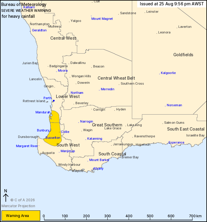
For people in parts of Lower West and South West districts.
Issued at 9:56 pm Tuesday, 25 August 2026.
Heavy rainfall affecting parts of the South West and Lower West
districts.
Weather Situation: A slow-moving cold front is producing
persistent rain with embedded thunderstorms, which is pushing
onshore about coastal areas and parts of the hills.
HEAVY RAINFALL which may lead to FLASH FLOODING is possible about
parts of the South West and Lower West districts. Six-hourly
rainfall totals between 30 and 60 mm are expected, with possible
localised falls up to 90 mm.
Heavy falls are expected to ease on Wednesday during the early
evening.
Locations which may be affected include Bunbury, Busselton,
Mandurah, Collie, Harvey and Dwellingup.
52.8 mm was recorded east of Busselton in the 2 hours to
9:30pm
The Department of Fire and Emergency Services advises that people
should:
* If outside find safe shelter away from trees, power lines, storm
water drains and streams.
* Close your curtains and blinds, and stay inside away from
windows.
* Unplug electrical appliances and do not use land line telephones
if there is lightning.
* If boating, swimming or surfing leave the water.
* Be alert and watch for hazards on the road such as fallen power
lines and loose debris.
* Keep away from flooded drains, rivers, streams and
waterways.
* Be careful of fallen trees, damaged buildings and debris.
* Be careful of fallen power lines. They are dangerous and should
always be treated as live.
* Assess your home, car and property for damage.
* If damage has occurred take photos and contact your insurance
company to organise permanent repairs.
* If your home or property has significant damage, like a badly
damaged roof or flooding, call the SES on 132 500.
25/Aug/2026 02:05 PM