Latest EWN Severe Weather Alerts
29/Jul/2026 02:32 AM
NT Bushfire Watch & Act: Leonino Road, Fly Creek
Source: NT Fire Incidents Bushfire Heading: Northwest Reported: Jul 29, 2026 11:30 AM Location: Leonino Road, FLY CREEK Type: Fire Status: Active Alert Level: Watch and Act Current Situation: Response Underway What to do: Enact your bushfire ... Read more...28/Jul/2026 06:51 AM
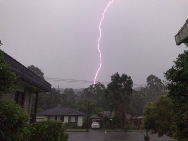
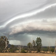
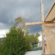
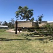
VIC Severe Weather Warning: Damaging Winds
Source: Bureau of Meteorology Refer to VicEmergency for AWS alerts For people in parts of East Gippsland, South West, North East and West and South Gippsland Forecast Districts. Issued at 4:43 pm Tuesday, 28 July 2026. Damaging winds possible ove ... Read more...28/Jul/2026 06:50 AM
VIC Severe Weather Warning: Damaging Winds
Source: Bureau of Meteorology Refer to VicEmergency for AWS alerts For people in parts of East Gippsland, South West, North East and West and South Gippsland Forecast Districts. Issued at 4:43 pm Tuesday, 28 July 2026. Damaging winds possible ove ... Read more...28/Jul/2026 06:33 AM
NSW Severe Weather Warning: Damaging Winds
Source: Bureau of Meteorology For people in parts of Snowy Mountains Forecast District. Issued at 4:25 pm Tuesday, 28 July 2026. Damaging winds possible over alpine areas today. Weather Situation: Northwesterly winds are increasing ahead of a col ... Read more...28/Jul/2026 01:23 AM
VIC Severe Weather Warning: Damaging Winds
Source: Bureau of Meteorology Refer to VicEmergency for AWS alerts For people in parts of East Gippsland, South West, North East and West and South Gippsland Forecast Districts. Issued at 10:54 am Tuesday, 28 July 2026. Damaging winds possible ov ... Read more...28/Jul/2026 01:22 AM
VIC Severe Weather Warning: Damaging Winds
Source: Bureau of Meteorology Refer to VicEmergency for AWS alerts For people in parts of East Gippsland, South West, North East and West and South Gippsland Forecast Districts. Issued at 10:54 am Tuesday, 28 July 2026. Damaging winds possible ov ... Read more...28/Jul/2026 01:20 AM
NSW Severe Weather Warning: Damaging Winds
Source: Bureau of Meteorology Issued at 10:50 am Tuesday, 28 July 2026. Damaging winds possible over alpine areas from this afternoon. Weather Situation: Northwesterly winds are increasing ahead of a cold front crossing the south of the state late ... Read more...27/Jul/2026 01:13 AM
VIC Severe Weather Warning: Damaging Winds
Source: Bureau of Meteorology Refer to VicEmergency for AWS alerts For people in parts of East Gippsland, South West, North East and West and South Gippsland Forecast Districts. Issued at 11:08 am Monday, 27 July 2026. Damaging winds possible ove ... Read more...27/Jul/2026 01:13 AM
VIC Severe Weather Warning: Damaging Winds
Source: Bureau of Meteorology Refer to VicEmergency for AWS alerts For people in parts of East Gippsland, South West, North East and West and South Gippsland Forecast Districts. Issued at 11:08 am Monday, 27 July 2026. Damaging winds possible ove ... Read more...27/Jul/2026 12:51 AM
NSW Severe Weather Warning: Damaging Winds
Source: Bureau of Meteorology For people in parts of Snowy Mountains Forecast District. Issued at 10:42 am Monday, 27 July 2026. Damaging winds and blizzards possible over alpine areas from Tuesday afternoon. Weather Situation: A cold front is fo ... Read more...26/Jul/2026 07:06 AM
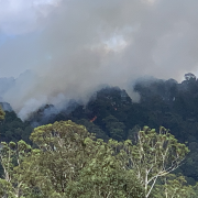
WA Bushfire Emergency Warning: Seven Mile in the Shire of Wyndham–East Kimberley
Source: Emergency WA Refer to EmergencyWA for AWS alerts Bushfire Heading: Northwest A Bushfire Emergency Warning is in place for people in the area south of King River Road and Great Northern Highway in SEVEN MILE in the SHIRE OF WYNDHAM EAST KIM ... Read more...26/Jul/2026 06:01 AM
WA Severe Thunderstorm Warning: Damaging Winds
Source: Bureau of Meteorology Refer to EmergencyWA for AWS alerts For people in parts of South West and South Coastal districts. Issued at 1:50 pm Sunday, 26 July 2026. Gusty strong showers are developing over coastal parts of the South Coastal t ... Read more...25/Jul/2026 09:47 AM
NT Bushfire Watch & Act: Galbraith Road, Bees Creek
Source: NT Fire Incidents Bushfire Galbraith Road, Bees Creek Notified: 25/07/2026 19:30 Fire Type Bushfire Location Galbraith Road, Bees Creek Current Situation Response Underway Status Being Controlled Alert Level Watch and Act Risks ... Read more...23/Jul/2026 07:08 AM
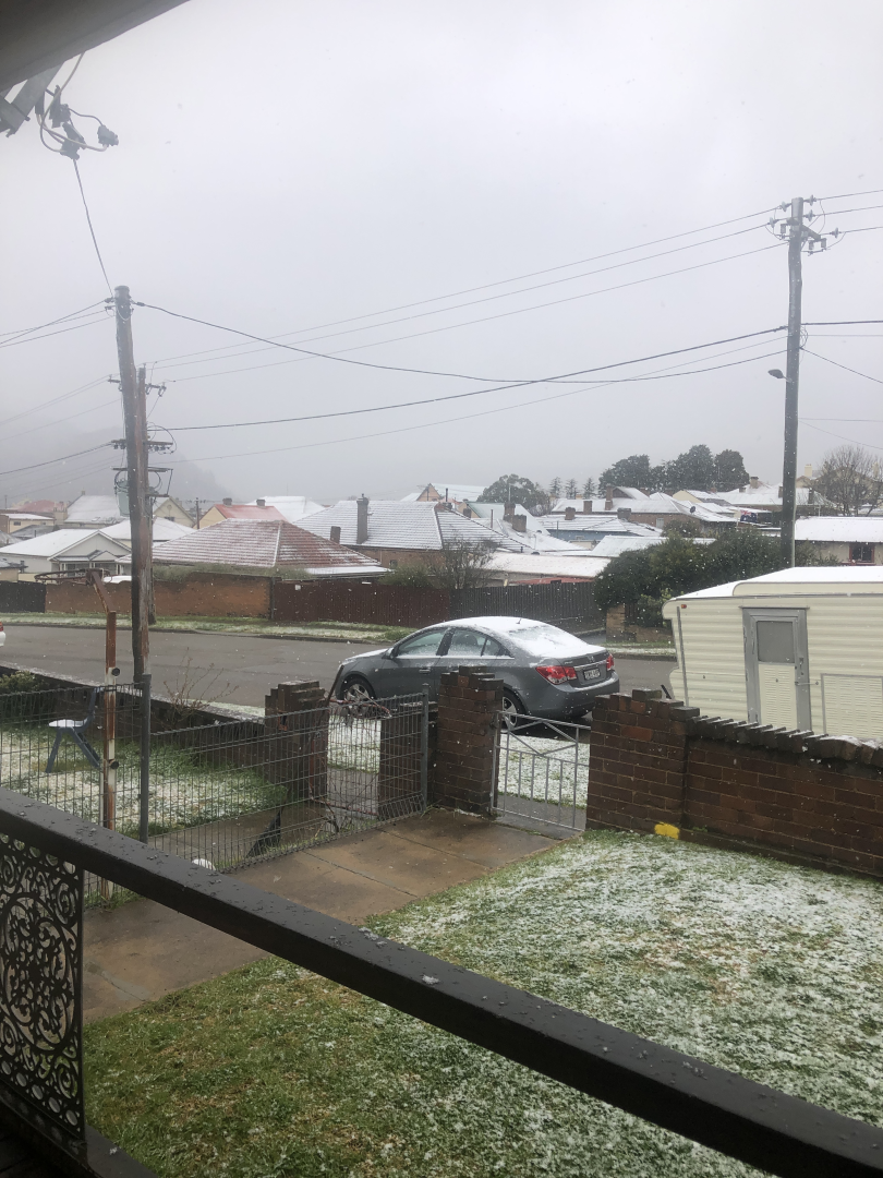
TAS Severe Weather Warning: Damaging Winds
Source: Bureau of Meteorology For people in parts of Western and South East Forecast Districts. Issued at 4:59 pm Thursday, 23 July 2026. Damaging winds about far southern Tasmania, easing Friday morning. Weather Situation: Increased west to sout ... Read more...23/Jul/2026 02:55 AM
NT Bushfire Watch & Act: McGorrie Road, MARRAKAI
Source: NT Fire Incidents Bushfire: McGorrie Road, MARRAKAI Notified: 23/07/2026 11:45 Fire Type: Bushfire Location: McGorrie Road, MARRAKAI Current Situation: Reported / Investigating Status: Going Alert Level: Watch and Act Risks: Active f ... Read more...23/Jul/2026 12:48 AM
TAS Severe Weather Warning: Damaging Winds
Source: Bureau of Meteorology For people in parts of Western and South East Forecast Districts. Issued at 10:41 am Thursday, 23 July 2026. Damaging winds possible about far southern Tasmania from late this afternoon. Weather Situation: A fast-mov ... Read more...22/Jul/2026 06:52 AM
TAS Severe Weather Warning: Damaging Winds
Source: Bureau of Meteorology For people in parts of Western and South East Forecast Districts. Issued at 4:39 pm Wednesday, 22 July 2026. Damaging winds possible about far southern Tasmania from Thursday afternoon. Weather Situation: A fast-movi ... Read more...22/Jul/2026 02:25 AM
NT Bushfire Watch & Act: Blyth Road, Livingstone
EWN THREAT LEVEL: AMBER NT Bushfire Watch Act: Blyth Road, Livingstone Source: NT Fire Incidents Bushfire Blyth Road, LIVINGSTONE Notified: 22/07/2026 11:30 Fire Type: Bushfire Location: Blyth Road, LIVINGSTONE Current Situation: Response Und ... Read more...22/Jul/2026 12:54 AM
TAS Severe Weather Warning: Damaging Winds
Source: Bureau of Meteorology For people in parts of Western and South East Forecast Districts. Issued at 10:49 am Wednesday, 22 July 2026. Damaging winds possible about far southern Tasmania from Thursday afternoon. Weather Situation: A fast-mov ... Read more...21/Jul/2026 02:58 AM
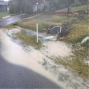
WA Flood Watch: Moore and Hill River Catchments
Source: Bureau of Meteorology Refer to EmergencyWA for AWS alerts This Flood Watch provides early advice of possible flooding within the specified catchments Flood Watch for the Moore and Hill River Catchments Issued at 10:50 am AWST on Tuesday 2 ... Read more...20/Jul/2026 03:36 AM
WA Flood Watch: Moore and Hill River Catchments
Source: Bureau of Meteorology Refer to EmergencyWA for AWS alerts Flood Watch Number: 6 ELEVATED RIVER LEVELS AND RENEWED RISES OCCURRING IN PARTS OF MOORE AND HILL RIVER CATCHMENTS Recent moderate rainfall across the Moore and Hill River catchme ... Read more...19/Jul/2026 02:17 AM
WA Flood Watch: Moore and Hill River Catchments
Source: Bureau of Meteorology Refer to EmergencyWA for AWS alerts Flood Watch for the Moore and Hill River Catchments Issued at 10:03 am AWST on Sunday 19 July 2026 Flood Watch Number: 5 ELEVATED RIVER LEVELS OCCURRING IN PARTS OF MOORE AND HILL ... Read more...18/Jul/2026 02:27 AM
WA Flood Watch: Moore and Hill River Catchments
Source: Bureau of Meteorology Refer to EmergencyWA for AWS alerts Issued at 10:17 am AWST on Saturday 18 July 2026 Flood Watch Number: 4 LOCALISED FLOODING OCCURRING IN PARTS OF MOORE AND HILL RIVER CATCHMENTS Moderate rainfall has been observed ... Read more...18/Jul/2026 01:53 AM
NT Bushfire Watch & Act: Chibnall Rd, Acacia Hills
Source: NT Fire Incidents Bushfire Chibnall Rd, ACACIA HILLS Notified: 18/07/2026 02:53 Fire Type Bushfire Location Chibnall Rd, ACACIA HILLS Current Situation Controlled Status Going Alert Level Watch and Act Risks Active fire may occ ... Read more...17/Jul/2026 03:51 AM
WA Flood Watch: Moore and Hill River Catchments
Source: Bureau of Meteorology Refer to EmergencyWA for AWS alerts ssued at 11:31 am AWST on Friday 17 July 2026 Flood Watch Number: 3 FLOODING POSSIBLE IN MOORE AND HILL RIVER CATCHMENTS FROM LATE FRIDAY A slow-moving trough is lingering over th ... Read more...