
Source: Bureau of Meteorology
Issued at 1:17 pm AEST on Sunday 29 June 2025
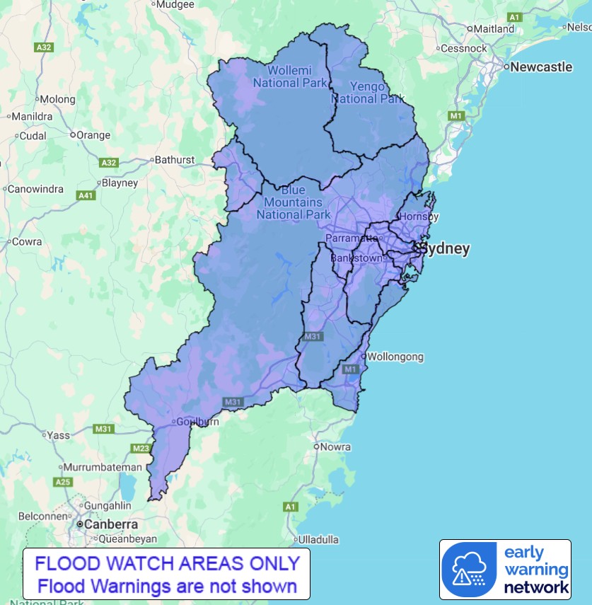
Flood Watch Number: 1
MINOR FLOODING POSSIBLE IN THE FLOOD WATCH AREA FROM TUESDAY
A trough will move east across the state today and deepen offshore
on Monday. A coastal low will develop in the trough on Tuesday and
move east across the Tasman Sea from Thursday. This low is expected
to bring widespread moderate to heavy rainfall across the flood
watch area and may cause minor flooding in several catchments from
Tuesday.
Catchments in the Flood Watch area are relatively wet following
recent rainfall.
There is some degree of uncertainty over the exact location and
timing of the heaviest falls. Localised river level rises, and
flash flooding are likely within the areas of heaviest
rainfall.
This weather system has the potential to cause minor flooding in
the Flood Watch area from Tuesday. Flood Classes (minor, moderate,
major) are only defined for catchments where the Bureau provides a
flood warning service.
Catchments likely to be affected include:
Upper Nepean RiverMinor flooding
Hawkesbury and Lower Nepean RiversMinor flooding
Upper Coxs River
Colo RiverMinor flooding
Macdonald RiverMinor flooding
Northern Sydney
Southern Sydney
Parramatta River
Cooks RiverMinor flooding
Georges and Woronora RiversMinor flooding
Illawarra Coast
For the latest flood and weather warnings see
http://www.bom.gov.au/australia/warnings
For the latest rainfall and river level information see
http://www.bom.gov.au/australia/flood
Safety Advice:
Don't drive, walk, swim or play in floodwater because it is
dangerous.
Stay away from flooded drains, rivers, streams and
waterways.
Obey road closure signs. Plan ahead so you don't drive on flooded
roads.
Check the ABC and local media for updates. The situation can
change quickly, so stay informed.
For local emergency management warnings and advice visit
www.ses.nsw.gov.au.
For emergency assistance call SES on telephone number 132 500. In
life-threatening emergencies, call 000 (triple zero)
immediately.
Rainfall and River
Conditions Map
29/Jun/2025 03:41 AM

