
Source: Bureau of Meteorology
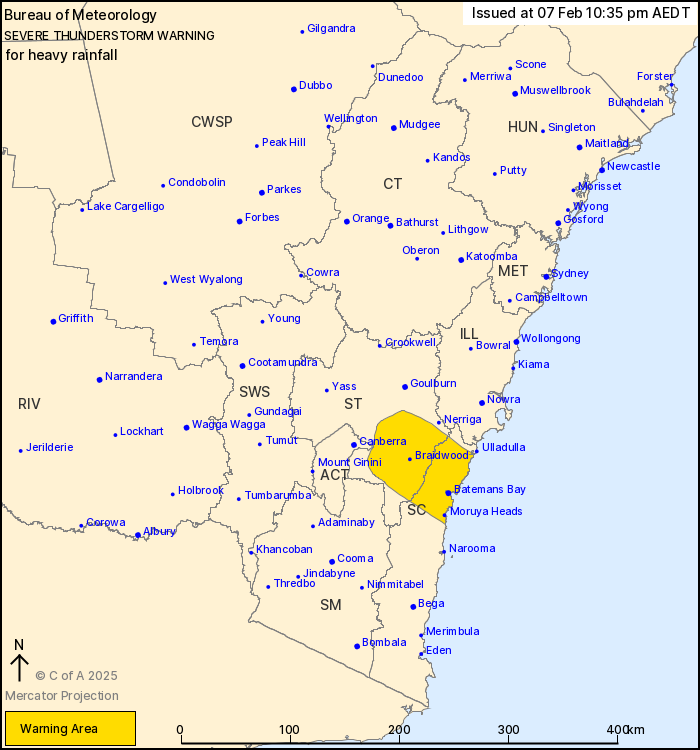
For people in parts of South Coast and Southern Tablelands
Forecast Districts.
Issued at 10:35 pm Friday, 7 February 2025.
Heavy falls continuing east of the ACT towards the coast.
Severe thunderstorms are likely to produce heavy rainfall that may
lead to flash flooding in the warning area over the next several
hours. Locations which may be affected include Batemans Bay,
Braidwood, Moruya Heads and Araluen.
Severe thunderstorms are no longer occurring in the South West
Slopes, Snowy Mountains and Australian Capital Territory districts
and the warning for these districts is CANCELLED.
27 mm was recorded at Googong Hill in the 30 minutes to 10:10
pm.
105 km/h wind gust was recorded at Wagga Wagga at 6:40 pm.
94 km/h wind gust was recorded at Griffith at 4:24 pm.
The State Emergency Service advises that people should:
* Keep clear of creeks and storm drains.
* Don't walk, ride your bike or drive through flood water.
* If you are trapped by flash flooding, seek refuge in the highest
available place and ring 000 if you need rescue.
* Be aware that run-off from rainfall in fire affected areas may
behave differently and be more rapid. It may also contain debris
such as ash, soil, trees and rocks.
* After bushfires, heavy rain and the loss of foliage can make the
ground soft and heavy, leading to a greater chance of
landslides.
* Unplug computers and appliances.
* Avoid using the phone during the storm.
* Stay indoors away from windows, and keep children and pets
indoors as well.
* Stay vigilant and monitor conditions. Note that the landscape
may have changed following bushfires.
* For emergency help in floods and storms, ring the SES (NSW and
ACT) on 132 500.
07/Feb/2025 11:47 AM


