
Source: Bureau of Meteorology
For people in parts of Central Tablelands Forecast District.
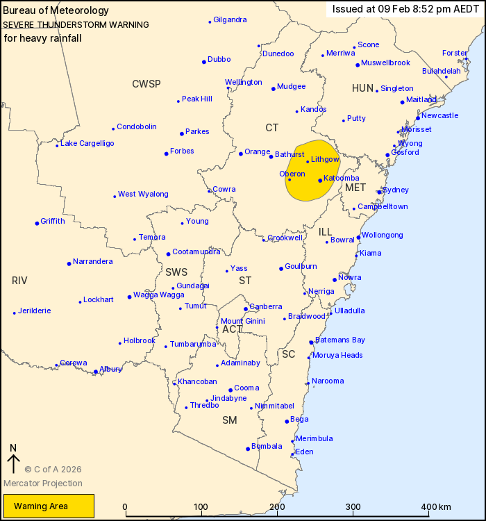
Issued at 8:52 pm Monday, 9 February 2026.
Heavy falls continuing near the Blue Mountains
Weather Situation: Slow-moving thunderstorms are continuing this
evening in a moist airmass. Heavy to intense rainfall has been
observed over the Blue Mountains, with things now slowly easing
back to moderate to locally heavy falls as a trough shifts to the
north.
Severe thunderstorms are likely to produce heavy rainfall that may
lead to flash flooding in the warning area over the next several
hours. Locations which may be affected include Katoomba, Lithgow,
Oberon, Jenolan Caves and Bilpin.
Severe thunderstorms are no longer occurring in the Illawarra,
South Coast, Southern Tablelands, South West Slopes and Snowy
Mountains districts and the warning for these districts is
CANCELLED.
51mm WAS RECORDED IN THE 30 MINUTES TO 8:53PM AT WENTWORTH
FALLS.
The State Emergency Service advises that people should:
* Keep clear of creeks and storm drains.
* Don't walk, ride your bike or drive through flood water.
* If you are trapped by flash flooding, seek refuge in the highest
available place and ring 000 if you need rescue.
* Stay indoors away from windows, and keep children and pets
indoors as well.
For emergency help in flood and storms, ring the SES on 132
500.
Stay updated on the Hazards Near Me NSW app or the ACT ESA website
(https://esa.act.gov.au).
09/Feb/2026 09:56 AM


