
Source: Bureau of Meteorology
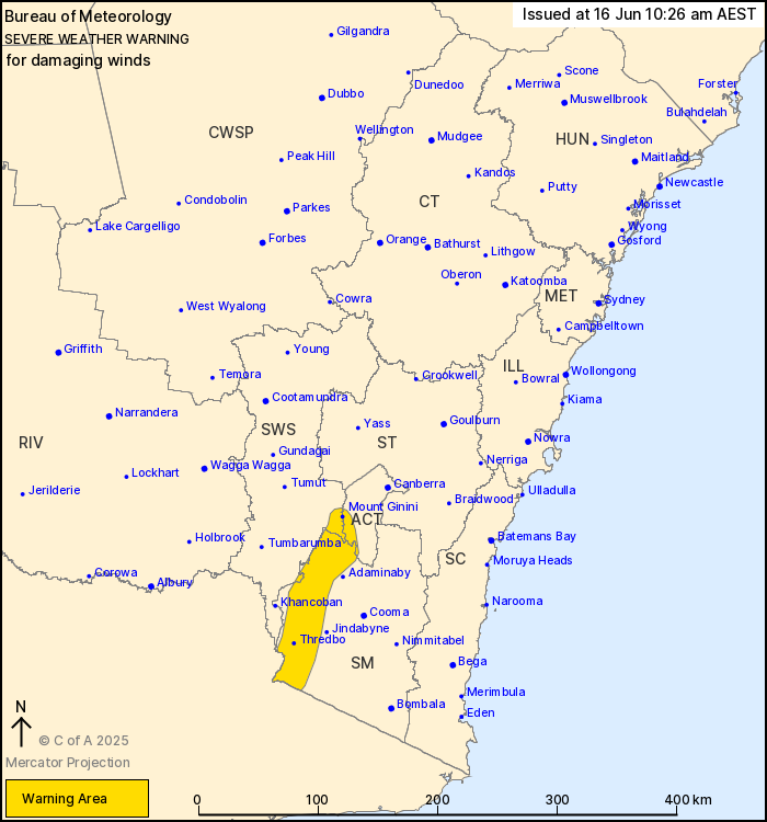
For people in parts of Snowy Mountains, Australian Capital
Territory and South West Slopes Forecast Districts.
Issued at 10:26 am Monday, 16 June 2025.
Damaging winds developing about Alpine areas on Tuesday.
Weather Situation: Westerly winds are expected to strengthen
across Alpine areas of southern New South Wales from early Tuesday
morning in response to a low pressure system well to the south of
the state.
DAMAGING WINDS averaging 60 to 70 km/h with peak gusts of around
100 km/h are likely about Alpine areas above 1400 m from early
Tuesday morning. Locations above 1900 m may see stronger winds
averaging 80 km/h.
Winds are expected to ease by Tuesday night.
Locations which may be affected include Mount Ginini, Thredbo,
Perisher Valley, Charlotte Pass, Cabramurra and Selwyn.
The State Emergency Service advises that people should:
* Move vehicles under cover or away from trees.
* Secure or put away loose items around your house, yard and
balcony.
* Keep at least 8 metres away from fallen power lines or objects
that may be energised, such as fences.
* Trees that have been damaged by fire are likely to be more
unstable and more likely to fall.
* Report fallen power lines to either Ausgrid (131 388), Endeavour
Energy (131 003), Essential Energy (132 080) or Evoenergy (131 093)
as shown on your power bill.
* Stay vigilant and monitor conditions. Note that the landscape
may have changed following bushfires.
* For emergency help in floods and storms, ring your local SES
Unit on 132 500.
16/Jun/2025 12:34 AM


