
Source: Bureau of Meteorology
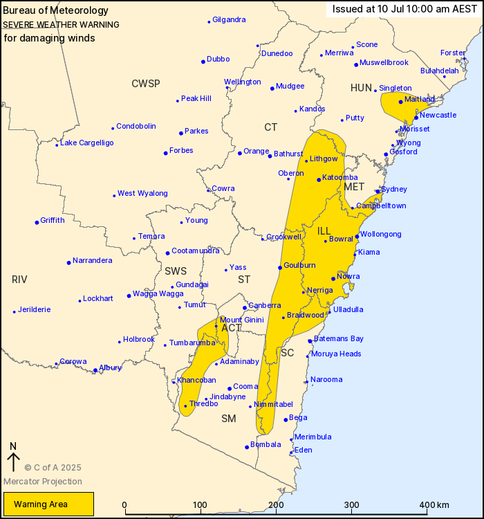
For people in Illawarra and parts of Hunter, Metropolitan, South
Coast, Central Tablelands, Southern Tablelands, Snowy Mountains,
Australian Capital Territory and South West Slopes Forecast
Districts.
Issued at 10:00 am Thursday, 10 July 2025.
Damaging winds developing today over parts of southeastern and
central eastern NSW, including Sydney, Wollongong and
Newcastle.
Weather Situation: A cold front continues to move eastwards over
the southern half of the state, moving offshore today.
Strengthening winds will range from northwest to southwesterly in
the wake of the system, and bring damaging winds across
southeastern and central eastern parts of NSW.
For the ILLAWARRA, SOUTH COAST ranges, and eastern parts of the
CENTRAL and SOUTHERN TABLELANDS: Strong west to southwesterly winds
with DAMAGING WIND GUSTS to around 100 km/h are developing this
morning and will continue into this evening.
For parts of the SYDNEY METROPOLITAN AREA: Strong westerly winds
with DAMAGING WIND GUSTS around 90 km/h are possible from late this
morning through to early evening.
For parts of the HUNTER including Newcastle: Strong westerly winds
with DAMAGING WIND GUSTS around 90 km/h are likely for a few hours
this morning and through the afternoon.
For parts of the SNOWY MOUNTAINS, ACT and SOUTH WEST SLOPES above
1300 metres: Strong westerly winds with DAMAGING WIND GUSTS in
excess of 90 km/h are likely today, and continuing into this
evening.
Winds are forecast to ease below damaging thresholds during Friday
morning, though winds will remain blustery throughout the
day.
Locations which may be affected include Wollongong, Nowra, Kiama,
Ulladulla, Sydney Airport, Campbelltown, Goulburn, Bowral,
Katoomba, Newcastle and Maitland.
91 km/h wind gust was reported at Newcastle Nobbys at
9:01am.
10/Jul/2025 12:13 AM


