
Source: Bureau of Meteorology
For people in parts of Snowy Mountains Forecast District.
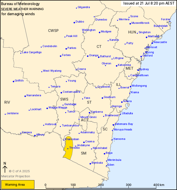
Issued at 8:20 pm Monday, 21 July 2025.
Damaging winds developing over Alpine areas above 1900m from this
evening, with blizzard conditions possible from Tuesday
morning.
Weather Situation: a strong cold front is approaching from the
west, and is expected to clear to the east of the state late on
Tuesday evening.
DAMAGING NORTHWESTERLY WINDS averaging 80 to 90 km/h are likely
over the Snowy Mountains above 1900m from this evening until
Tuesday evening.
BLIZZARD conditions are also forecast above 1900m from Tuesday
morning until Tuesday evening. The NSW National Parks and Wildlife
Service recommends that back country travel be postponed until
conditions improve.
Locations which may be affected include Thredbo Top Station.
The State Emergency Service advises that people should:
* Move vehicles under cover or away from trees.
* Secure or put away loose items around your house, yard and
balcony.
* Keep at least 8 metres away from fallen power lines or objects
that may be energised, such as fences.
* Trees that have been damaged by fire are likely to be more
unstable and more likely to fall.
* Report fallen power lines to either Ausgrid (131 388), Endeavour
Energy (131 003), Essential Energy (132 080) or Evoenergy (131 093)
as shown on your power bill.
* Stay vigilant and monitor conditions. Note that the landscape
may have changed following bushfires.
* For emergency help in floods and storms, ring your local SES
Unit on 132 500.
21/Jul/2025 10:45 AM


