
Source: Bureau of Meteorology
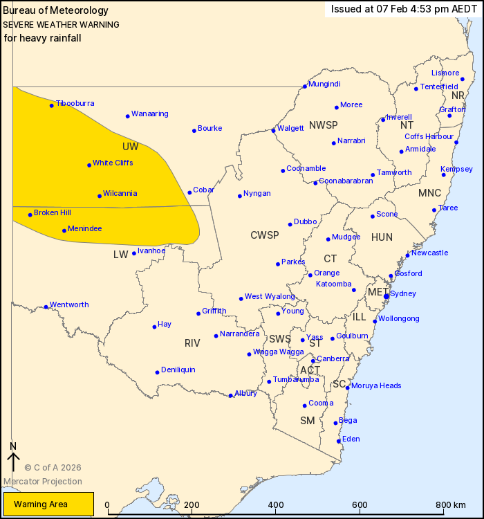
For people in parts of Lower Western and Upper Western Forecast
Districts.
Issued at 4:53 pm Saturday, 7 February 2026.
Heavy rainfall about parts of far western New South Wales this
weekend.
Weather Situation: A humid tropical airmass has spread across
northwest New South Wales. Widespread areas of rain and isolated
thunderstorms forced by a series of troughs will tap into this
moisture, bringing periods of heavy rainfall.
HEAVY RAINFALL which may lead to FLASH FLOODING is forecast in
parts of the Upper Western and Lower Western districts this
weekend. Six-hourly rainfall totals between 20 and 50 mm are likely
with localised totals up to 75 mm possible with thunderstorm
activity.
Conditions should start to ease from late Sunday, before clearing
during Monday morning.
Locations which may be affected include Tibooburra, Broken Hill,
Wilcannia, White Cliffs, Menindee and Tilpa.
63.8 mm of rainfall was recorded at Fowlers Gap in the 6 hours to
3:34 pm.
The State Emergency Service advises that people should:
* Don't drive, ride or walk through flood water.
* Keep clear of creeks and storm drains.
* If you are trapped by flash flooding, seek refuge in the highest
available place and ring 000 if you need rescue.
For emergency help in flood and storms, ring the SES on 132
500.
Stay updated on the Hazards Near Me NSW app or the ACT ESA website
(https://esa.act.gov.au).
07/Feb/2026 05:56 AM


