
Source: Bureau of Meteorology
Issued at 2:06 pm ACST on Wednesday 19 November 2025
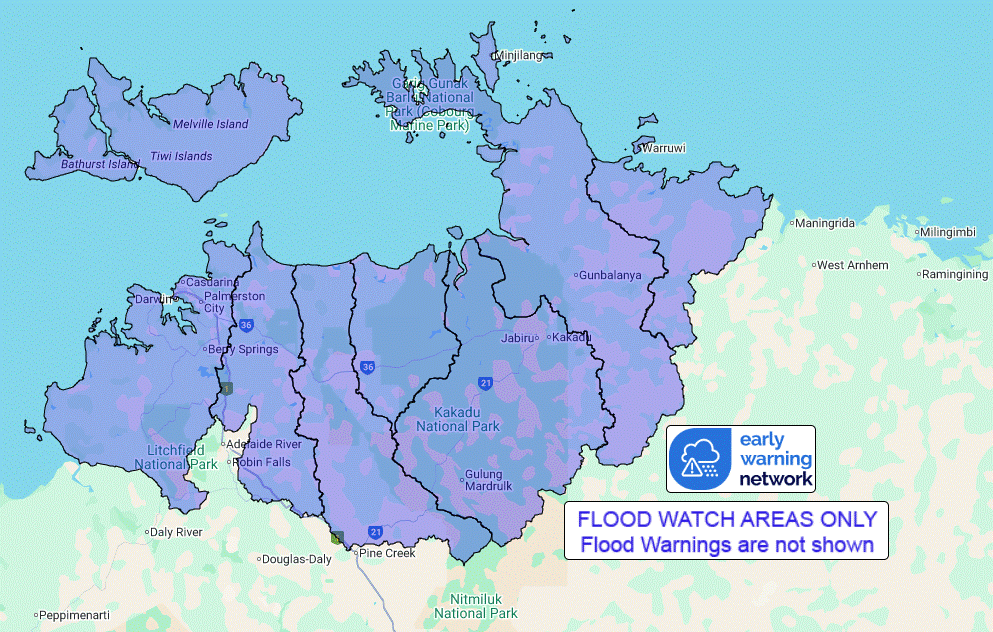
Flood Watch Number: 1
SIGNIFICANT RISES IN CREEKS AND RIVERS POSSIBLE FROM LATE
FRIDAY
Tropical Cyclone Fina is expected to move eastwards and intensify
to Category 2 by Wednesday night. Later on Thursday it should turn
to the south then southwest, taking it towards the Northern
Territory coast for a potential impact during Friday and
Saturday.
Most of the Top End catchments are wetting up from the recent
showers and storms. Locally heavy falls are possible along coastal
areas between the Tiwi Islands and Milingimbi from Friday.
Widespread rainfall totals over the Flood Watch area on Saturday
are likely to be 40-140 mm, with isolated totals over 200mm is
possible near the path of the cyclone.
Significant rises in creeks and rivers and areas of flooding are
possible throughout the Flood Watch area from late Friday. Many
roads may become impassable and some communities and homesteads may
become isolated.
Catchments likely to be affected include:
Finniss River
Tiwi Islands
Adelaide River below Adelaide River Town
Mary River
Wildman River
South Alligator River
East Alligator River
Goomadeer River
A tropical cyclone advice is current for parts of the Top End west
coast.
For the latest flood and weather warnings see
www.bom.gov.au/weather-and-climate/warnings-and-alerts
For the latest rainfall and river level information see
www.bom.gov.au/australia/flood
Safety Advice:
Don't drive, walk, swim or play in floodwater because it is
dangerous.
Stay away from flooded drains, rivers, streams and
waterways.
Obey road closure signs. Plan ahead so you don't drive on flooded
roads.
Check the ABC and local media for updates. The situation can
change quickly, so stay informed.
For local emergency management warnings and advice visit
www.securent.nt.gov.au.
For emergency assistance call SES on telephone number 132 500. In
life-threatening emergencies, call 000 (triple zero)
immediately.
Rainfall and River
Conditions Map
19/Nov/2025 04:50 AM

