
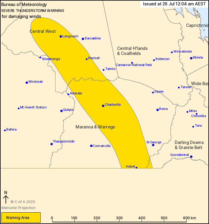
Source: Bureau of Meteorology
For people in parts of Central West, Maranoa and Warrego, Channel
Country and Darling Downs and Granite Belt Forecast
Districts.
Issued at 12:04 am Saturday, 26 July 2025.
Severe thunderstorms continue over the interior this
morning.
Weather Situation: A vigorous cold front crossing inland parts of
the state is producing severe thunderstorms. Thunderstorms are
expected to track eastwards during early Friday morning.
Severe thunderstorms are likely to produce damaging winds in the
warning area over the next several hours. Locations which may be
affected include Charleville, Longreach, Blackall, Hebel, Isisford
and Bollon.
Emergency services advise people to:
* Park your car undercover away from trees.
* Close doors and windows.
* Keep asthma medications close by. Storms and wind can trigger
asthma attacks.
* Charge mobile phones and power banks in case the power goes
out.
* Put your pets somewhere safe and make sure they can be
identified in case they get lost.
* Do not drive now unless you have to because conditions are
dangerous.
* Tell friends, family and neighbours in the area.
* Go inside a strong building now. Stay inside until the storm has
passed.
25/Jul/2025 02:14 PM


