
Source: Bureau of Meteorology
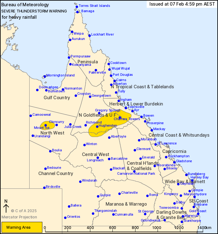
For people in parts of Northern Goldfields and Upper Flinders,
Herbert and Lower Burdekin, North West and Central West Forecast
Districts.
Issued at 4:59 pm Friday, 7 February 2025.
Heavy rainfall has developed in the Mount Isa area.
Weather Situation: A monsoon trough persists about the southern
Cape York Peninsula, with an embedded low south of Georgetown, in
an environment rich in tropical moisture. Enhanced shower and
thunderstorm activity will result in the risk of heavy rainfall
through parts of northern Queensland.
Severe thunderstorms are likely to produce heavy rainfall that may
lead to flash flooding in the warning area over the next several
hours. Locations which may be affected include Mount Isa, Charters
Towers, Hughenden, Pentland, Clare and Stamford.
61.4 mm was recorded at Carters Bore in the 1 hour to 4:45
pm.
Emergency services advise people to:
* Park your car undercover away from trees.
* Close doors and windows.
* Keep asthma medications close by. Storms and wind can trigger
asthma attacks.
* Charge mobile phones and power banks in case the power goes
out.
* Put your pets somewhere safe and make sure they can be
identified in case they get lost.
* Do not drive now unless you have to because conditions are
dangerous.
* Tell friends, family and neighbours in the area.
* Go inside a strong building now. Stay inside until the storm has
passed.
07/Feb/2025 07:07 AM


