
Source: Bureau of Meteorology
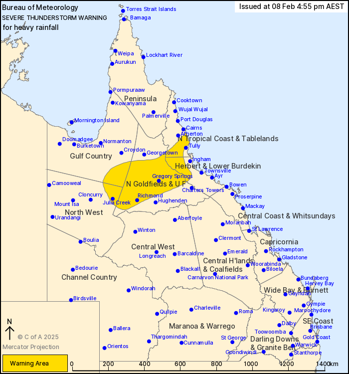
For people in parts of Gulf Country, North Tropical Coast and
Tablelands, Northern Goldfields and Upper Flinders, Herbert and
Lower Burdekin and North West Forecast Districts.
Issued at 4:55 pm Saturday, 8 February 2025.
Heavy rainfall continues in the north Queensland interior this
afternoon.
Weather Situation: A monsoon trough lies across the northern
Queensland interior in an environment rich with tropical moisture,
allowing the development of slow-moving heavy showers and severe
thunderstorms.
Severe thunderstorms are likely to produce heavy rainfall that may
lead to flash flooding in the warning area over the next several
hours. Locations which may be affected include Richmond, Julia
Creek, Innisfail, Babinda, Gregory Springs and Cloney's
Creek.
108 mm was recorded at Savanah in the 3 hours to 12:00 pm.
Emergency services advise people to:
* Park your car undercover away from trees.
* Close doors and windows.
* Keep asthma medications close by. Storms and wind can trigger
asthma attacks.
* Charge mobile phones and power banks in case the power goes
out.
* Put your pets somewhere safe and make sure they can be
identified in case they get lost.
* Do not drive now unless you have to because conditions are
dangerous.
* Tell friends, family and neighbours in the area.
* Go inside a strong building now. Stay inside until the storm has
passed.
08/Feb/2025 07:04 AM


