
Source: Bureau of Meteorology
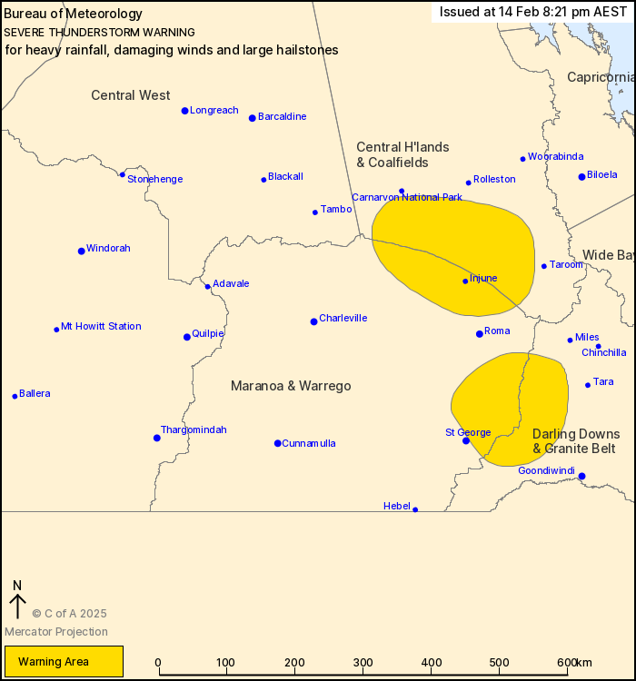
For people in parts of Central Highlands and Coalfields, Maranoa
and Warrego and Darling Downs and Granite Belt Forecast
Districts.
Issued at 8:21 pm Friday, 14 February 2025.
Severe thunderstorms continue in southern inland Queensland this
evening.
Weather Situation: A surface trough in the Queensland interior,
connected to a low in the Maranoa and Warrego, is immersed in a
moist and unstable airmass. Severe thunderstorms are possible
throughout interior parts of the state this evening.
Severe thunderstorms are likely to produce heavy rainfall that may
lead to flash flooding, damaging winds and large hailstones in the
warning area over the next several hours. Locations which may be
affected include Injune and Surat.
Severe thunderstorms are no longer occurring in the Central West
and Wide Bay and Burnett districts and the warning for these
districts is CANCELLED.
44 mm was recorded at Mount Aunt (near Mareeba) in the 30 minutes
to 4:54 pm.
35 mm was recorded at Raceview (near Charleville) in the 30
minutes to 4:46 pm.
Emergency services advise people to:
* Park your car undercover away from trees.
* Close doors and windows.
* Keep asthma medications close by. Storms and wind can trigger
asthma attacks.
* Charge mobile phones and power banks in case the power goes
out.
* Put your pets somewhere safe and make sure they can be
identified in case they get lost.
* Do not drive now unless you have to because conditions are
dangerous.
* Tell friends, family and neighbours in the area.
* Go inside a strong building now. Stay inside until the storm has
passed.
14/Feb/2025 10:30 AM


