
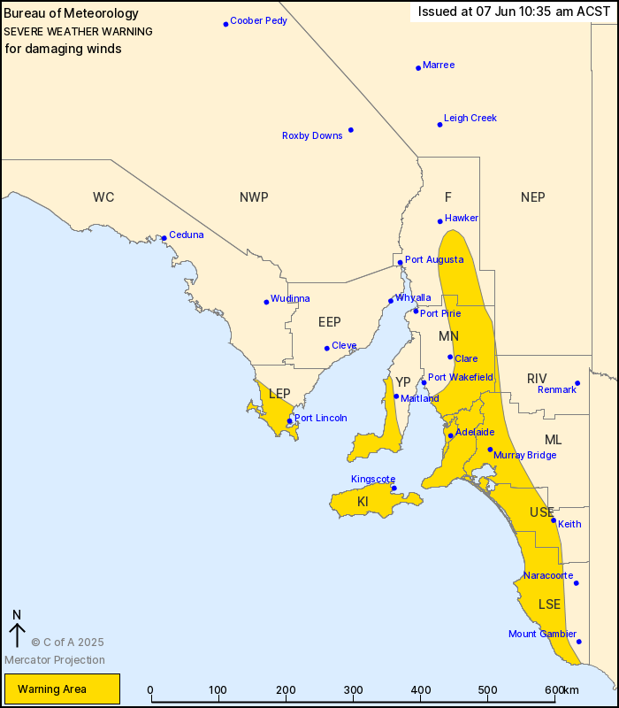
Source: Bureau of Meteorology
For people in Adelaide Metropolitan, Mount Lofty Ranges, Mid
North, Kangaroo Island, Lower South East and parts of Lower Eyre
Peninsula, Yorke Peninsula, Flinders, Murraylands, Upper South
East, Riverland and North East Pastoral districts.
Issued at 10:35 am Saturday, 7 June 2025.
Damaging winds likely this morning and afternoon with the passage
of a cold front.
Weather Situation: A complex low pressure system located over the
Southern Ocean extends a strong cold front over South Australia
today. The risk of damaging west to southwesterly winds is expected
from late this morning and during the afternoon.
For COASTAL AREAS including ADELAIDE METRO AREA: DAMAGING WINDS
averaging 65 to 75 km/h with peak gusts in excess of 90 km/h are
likely from late morning. For coastal areas of southern Fleurieu
Peninsula, Upper South East and Lower South East DAMAGING WIND
GUSTS of around 100 km/h are possible from late morning, especially
with showers and thunderstorms.
For ELEVATED AREAS including MOUNT LOFTY RANGES AND FLINDERS
RANGES: Strong to DAMAGING WINDS averaging 55 to 65 km/h with peak
gusts in excess of 100 km/h are possible from late morning.
Winds are forecast to ease below warning thresholds for most areas
during Saturday evening, however, exposed coastal areas may see a
risk of DAMAGING WIND GUSTS continue until the late evening.
Locations which may be affected include Adelaide, Port Lincoln,
Murray Bridge, Kingscote, Meningie and Jamestown.
93 km/h wind gust was recorded at Cape Borda at 9:22 am.
The State Emergency Service advises that people should:
* Move vehicles under cover or away from trees;
* Secure or put away loose items around your property.
* Stay indoors, away from windows, while conditions are
severe.
07/Jun/2025 01:13 AM

